| |
BRIEF
HISTORY OF GRAFTON CO., NEW HAMPSHIRE
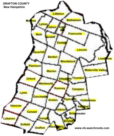
Grafton County is one of 10 counties in New Hampshire.
The county is in the Lebanon metro area. Extending
far into its northern limits lies the famous White
Mountain region, while in its southern and central
parts, and all along the Connecticut, are a thousand
scenes of storied or of unsung loveliness. Grafton
County was originally known as "The Fifth,"
established by an act of the Colonial legislature
passed March 19, 1771, in which it was made to contain
"all the lands in the Province not comprehended
in the other counties," (viz: Hillsborough, Rockingham,
Cheshire and Strafford) its name being given in honor
of Augustus Henry Fitzroy, Duke of Grafton. This act
created a county which was an immense tract of land,
extending south from what is now the Canada line for
a distance of nearly 150 miles. This territory was
divided as early as November 27, 1800, when the township
of Burton [whose name was changed to Albany] was annexed
to Strafford county. Three years later, December 24,
1803, the whole of the northern half of Grafton county
was set off to form the new county of Coos, and finally
on June 18, 1805, the area was reduced once again
by the annexation of the whole of a tract known as
"Nash and Sawyer's Location" to Coos County.
After all these reductions, by an act of the legislature,
passed January 2, 1829, the boundaries of the county
were fixed, from which since there has been made no
material change. This place's the county's 1,463 square
miles of territory between 43 degrees 27' and 44 degrees
22' north latitude, and between 71 degrees 20' and
72 degrees 20' longitude west from Greenwich, bounded
north by Coos county, east by Coos, Carroll and Belknap
counties, south by Merrimack and Sullivan Counties,
and west by the west bank of the Connecticut river,
its greatest length being fifty-eight miles and its
greatest breadth thirty miles. It is divided into
thirty-nine towns, twenty-nine of which were granted
under King George II -- eleven in the second year
of his unfortunate reign, in 1761 -- and ten under
the State government. In the northern section are
mountains belonging to the White Mountain range, Franconia
mountains and Carrigain mountain; a little to the
southwest, in Benton, is Moosilauke, towering to an
altitude of 4,811 feet... while at the east and southeast
is a part of the Whiteface, in Waterville, and the
Campton mountains in Campton and vicinity. The southern
section, though rough and broken, partkes more of
a hilly than a mountainous nature. In the western
section it is watered by the Connecticut and its tributaries,
the largest of which are the Lower and Wild Ammonoosuc
rivers, and in the norther part, and Mascoma in the
southern section. The Pemigewasset and its branches
water the central portion. The principal bodies of
water are part of Squam Lake in the southeastern section,
Newfound Lake in the southern, and Mascoma in the
southwestern portion. [From "Gazetteer of
Grafton Co NH, by Hamilton Child; Syracuse NY, 1886].
The county seat is Haverhill NH.
Learn more about
Grafton County's History
Learn more about Grafton
County's geography and current
condition
DOCUMENTS
(this site) for genealogical research
OTHER
AREAS OF RESEARCH FOR GRAFTON COUNTY (this site)
- SEE
Grafton County genealogical
resources
- SEE
Researching family trees
in New Hampshire and Grafton County
- HISTORY
& GENEALOGY (County-wide)
- Locate
a historical society in New Hampshire
- Grafton
County Probate Office:
3785 Dartmouth College Highway Box 3
North Haverhill, NH 03774-4936
Email: Grafton.Probate@court.state.nh.us
Office Hours: 8:00 - 4:00 Phone: 603-787-6931
- Note:
Records prior to 1900 are in the NH State Archives
Grafton County Probate Office
- Online
Book: Biographical Sketches of Leading Citizens
of Grafton County, New Hampshire, 1897. Internet
Archive
- Heritage
Listings (Historic Societies and Heritage Sites:
Grafton Co.
NH (Arts Alliance of Northern NH)
- Vital
Statistics, Births 1600-1900 Grafton County NH
- State Archives, Drawer 78 "A" names
(dates range from 1772-1900) archive - USGenWeb
[web
page]
- Online
Book: Biographical
Sketches of leading citizens of Grafton County,
New Hampshire, 1897
- Grafton
County NH History
at FamilySearch
- Crawford
Family of Grafton County NH - pdf,
from web site archive
- Crawford
Family Forum (Genealogy.com)
- Gazetteer
of Grafton County, NH, Volumes 1709-1886
(Google eBook) Syracuse Journal Company, Printers,
1886 [searchable]
- Grafton
County NH
- USGenWeb (link dead) | older
archives
- Upper
Connecticut Valley Genealogies & Information
- National
Register of Historic Places - for Grafton
County NH
- Political
Graveyard - Grafton County - politicians and/or
(in) famous people, cemetery listings
- Photographs
of tombstones located in:
- Alexandria (Burns Hill Cemetery, Crawford
Cemetery, Scott-Patten Cemetery, Lone Grave of
Jane Lock)
- Bridgewater (Tobine Tobyne Brown Cemetery,
Turnpike Cemetery, Webster-Cross Cemetery)
- Bristol (Heath Yard, Keyser Cemetery,
Sanborn Cemetery, Worthen Cemetery)
- Danbury (A Small Plot in the woods, Ward Hill
Cemetery)
- Franklin (Shaw's Corner Cemetery)
- Hebron (Graveyard behind Hebron Church
- Hill (Bunker Hill Cemetery, Graveyard
behind Hill Center Church, Thompson-Hillard Cemetery)
- New Hampton (Favor Cemetery)
- Additional photographs from Alexandria, Bridgewater,
Bristol, Danbury, Groton, Hebron and Hill to be
added [towns of Bridgewater, Bristol and Hill
were once part of a town known as New Chester].
- Three
Ancient Cemeteries
(tombstone transcriptions of Old Pine Cemetery,
East Plainfield Cemetery, and Leavitt Cemetery)
- located in Grafton county, New Hampshire, in
the town of Enfield, near the boundary line that
separates that township from that of Lebanon.
- Other
Genealogical Resources in Grafton Co NH - Rootsweb
- Article:
The White and Franconia Mountains - The Bay
State monthly. / Volume 3, Issue 2, 1885, from
Cornell University, The Making of America
- PROFILE
& STATISTICS
- PHOTOGRAPHS
(also see individual towns):
- BUSINESS:
- FUN:
- NEWS
IN GRAFTON COUNTY (newspapers & online):
- MAPS:
|
|
|
|
|
|
|
|
|
|
|
|
|
| |
|
|
|
|
| |
|
| |
|
| |
|
|
|
|
|
Current
communities in Grafton County include:Alexandria,
Ashland, Bath,
Benton, Bethlehem,
Bridgewater, Bristol,
Campton, Canaan,
Dorchester, Easton,
Ellsworth, Enfield,
Franconia, Grafton,
Groton, Hanover,
Haverhill, Hebron,
Holderness, Landaff,
Lebanon, Lincoln,
Lisbon, Littleton,
Livermore, Lyman,
Lyme, Monroe, Orange,
Orford, Piermont,
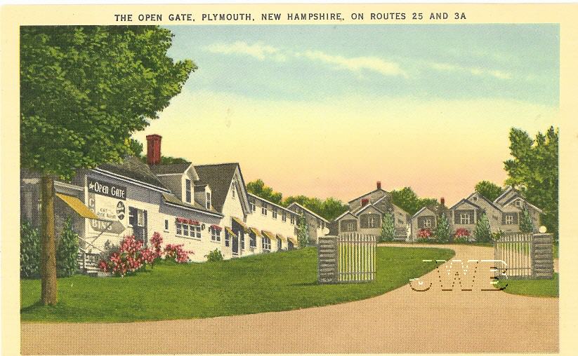
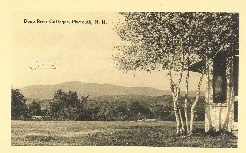
Plymouth, Rumney,
Sugar Hill, Thornton,
Warren, Waterville
Valley, Wentworth, and Woodstock.
|
|
|
| |
|
|
TOWNS
/ CITIES IN GRAFTON COUNTY, New Hampshire
ALEXANDRIA
- Brief
History: First granted in 1753, Alexandria was named
for Alexandria, Virginia, location of a conference that
resulted in the declaration of the French and Indian War.
It was incorporated as its current township in 1782. Alexandria
NH was the birthplace of Luther C. Ladd, the first enlisted
soldier to lose his life in the Civil War. Newfound Lake
is in the northeast corner, with Wellington State Park on
the western shore. The town is home to Welton Falls State
Forest. Cardigan State Park, with Mount Cardigan, is in
the west. Another attraction is Mount Mowglis, named for
Rudyard Kipling's Jungle Book hero.
- Villages
and Place Names:
South Alexandria, Alexandria Center
- PROFILE
& STATISTICS:
- GOVERNMENT:
- OTHER
WEB SITES:
- History
& Genealogy: Alexandria, N.H.
- Margaret
Ann Roby Loring of Alexandria NH - likeness
and brief biography
- Some
Early and Important Residents of Alexandria NH
-John Moore Corliss, Corliss Family (Elihu, Daniel,
Rachel), George Templeton Crawford, Timothy Haynes,
M.D., Elijah Locke, Luke Sumner (PDF).
- History
& Genealogy of Alexandria NH
- TXT file
(this site) - Geography and early history of the town;
description of the town in 1885; villages; town library;
manufactures; settlement of the town including list
of inhabitants in 1773, brief history of the Free Will
Baptist Church; brief biographies and some genealogy
of the following early settlers and later residents,
including: Eliphalet Gale, Alexander McMurphy, Moses
Atwood, Stephen Bullock, Hezekiah Bullock, John Patten,
Robert Patten, William Pattee, Jonathan Tilton, Samuel
Tilton, Jesse Gordon, Oliver Ballou, Robert Simonds,
Nathan Butterick, Elliot Healy, John Pitman, Phineas
Ackerman, Peter Ackerman, Thomas Hutchins, Ezra T. GIfford,
John Noyes, Samuel P. Heath, Lewis Chamberlin, Nathaniel
Berry, Rev. William Saunders, David Cheney, William
Tucker, Joseph Kelley, Peter Sleeper, Samuel Thisell,
James Dalton, Samuel Davis, David Rollins, Rev. McDonald
Martin, John Phillips, and Ebenezer Ferrin (and their
families). [Source: Gazetteer of Grafton County NH,
1709-1886, compiled and published by Hamilton Child;
Syracuse NY, The Syracuse Journal Company, Printers
and Binders, June 1886]
- Biography
& Genealogy -- Alexandria
New Hampshire Author and Teacher, Louise Lamprey
(1869-1951) - blog, Cow Hampshire
- 1810
US Census of Alexandria NH - Txt file - USGenWeb
Archives
- Tombstone
Photographs
- Burns
Hill Cemetery, Alexandria NH
- Tombstone
Photographs - Crawford
Cemetery, Alexandria NH
- Tombstone
Photographs - Scott-Patten
Cemetery, Alexandria NH
- Tombstone
Photograph: Lone
Grave of Jane Lock, Alexandria NH
- PHOTOGRAPHS/POSTCARDS:
- BUSINESS:
- MAPS:
ASHLAND
- Brief
History: Once the southwest section of Holderness, Ashland
was not incorporated until 1868. It was named in honor of
Henry Clay, for his birthplace in Ashland, Virginia, and
his estate in Kentucky. Ashland includes the geographic
center of the state, located just west of Lake Winnipesaukee.
- Villages
and Place Names:
- Profile
& Statistics:
- GOVERNMENT:
- History
& Genealogy: Ashland N.H.
- History
& Genealogy of Ashland NH - TXT file
(this site) - Geography and description of the town
of Ashland NH; refer to town of Holderness for earliest
history; description of town and villages in 1885; business
and manufactures circa 1885 with some earlier ownership;
churches in Ashland NH; biographies and some genealogy
of (then) current residents including Robert Huckins,
Simon Harris, James Ames, Capt. Thomas Cox, Barnett
Hughes, Stephen Chase Baker, William Corliss, David
Carr, William Currier, Levi Drew, Enoch Rogers, Nathaniel
Cummings, Elias Ladd, Hon. Samuel Livermore, Jacob Peaslee,
Horatio N. Smythe, David Calley, John Shepard, Benning
M. Plaisted, Robert Deane, Jonathan Smith, Nathan Pierce,
Cyrus C. Plaisted, Samuel Brown, Reuben B. Rollins,
Samuel Dustin, Stephen N. Morse, John Hughes (and son
Barnett Hughes), Leonard Moore, Paul Abbott (son of
Darius), Edwin Dearborn, Nathan Goss, Simeon Batchelder,
Samuel Scribner, Ambrose Scribner, Jonathan F. Keyes.
[Source: Gazetteer of Grafton County NH, 1709-1886,
compiled and published by Hamilton Child; Syracuse NY,
The Syracuse Journal Company, Printers and Binders,
June 1886]
- The
Granite Monthly, January 1901: Ashland--Its
Past and Present
- George
Hoyt Whipple
was born on August 28, 1878, in Ashland, New Hampshire,
the son of Dr. Ashley Cooper Whipple and his wife Frances
Hoyt. His paternal grandfather and his father, both
physicians, were born and bred in New Hampshire.For
this work on the therapeutic value of liver in the treatment
of pernicious anaemia he was awarded, together with
George R. Minot and William P. Murphy, the Nobel Prize
for Physiology or Medicine in 1934.Whipples Disease
is named after him.
- Some
Early Settlers and Important People of Ashland NH
including Ora Alden Brown, Person Colby Cheney, George
B. Cox, Hon. Hiram Hodgedon, George Hoyt Whipple - PDF.
- BUSINESS:
- PHOTOGRAPHS
& POSTCARDS:
- Person
Colby Cheney (1828-1901) — also known as Person
C. Cheney — of Manchester, Hillsborough County,
N.H. Born in Ashland, Grafton County, N.H., February
25, 1828. Republican. Member of New Hampshire state
house of representatives, 1854; served in the Union
Army during the Civil War; mayor of Manchester, N.H.,
1871; Governor of New Hampshire, 1875-77; U.S. Senator
from New Hampshire, 1886-87 (serving out unexpired term
of Austin F. Pike); member of Republican National Committee
from New Hampshire, 1888-1900; U.S. Minister to Switzerland,
1892-93. Died in Dover, Strafford County, N.H., June
19, 1901. Interment at Pine Grove Cemetery, Manchester,
N.H. [link dead Oct 2017]
- Bird's
Eye View of Ashland, NH, 1883 - American Memory
- Ashland
NH at Flickr
(photographs)
- Historic
Ashland School [original link is dead, this is link
to Archive, loads slowly]
- Several
Photographs of Ashland NH
- Old
Postcard-Stinson Lake Inn, Stinson Lake, Ashland NH
- USGenWeb
(Grafton Co)
- MAPS:
BATH
- Brief
History: The charter of the town of Bath, granted in
1761, set aside land in equal shares for 68 families, with
a church and a school. The town was named for one of England's
prominent statesmen, William Pulteney, first Earl of Bath.
- Villages
and Place Names: Nutter, Pettyboro, Swiftwater,
Upper Village, West Bath, The Narrows
- Profile
& Statistics:
- GOVERNMENT:
- Bath
Town Clerk
P.O. Box 88
Bath NH 03740
Telephone: 603-747-2454
Fax: 603-747-0497
- Bath
Public Library
P.O.
Box 5 - Route 302
Bath, NH 03740-0005
Telephone: (603) 747-3372
- Bath
Historical Society
PO Box 44
Bath NH 03740
- Bath
Historical Society
Address: PO Box 44, Bath, NH 03740
Contact: Velma Ide, 603-747-2085
Alt Tel #: 603-747-2454
Description: No Museum at this time. Call to make an appointment
to see artifacts or for genealogy assistance.
- History
& Genealogy:
- History
& Genealogy of Bath, NH
- TXT file
(this site) - Geography and descripton of Bath NH and
its villages; description of Bath in 1885; 1885 business
and manufactures; the settlement of the town with names
and dates of earliest settlers; first in the town (i.e.
first birth, first death); Bath during the American Revolution;
Churches of Bath NH; Brief Biographies and some Genealogies
of the following: Jeremiah Hutchins; Andrew S Woods, William
Eastman and the Eastman Family, Samuel Lang, Henry S.
Lang, William H. Lang, Amasa Buck, John Hibbard, William
A. Woods, Frederick Hibbard, Timothy Hibbard, Phineas
Chamberlin, Seth Chamberlin, Martin C. Powers, William
V. Hutchins, William Southard, Dan Clough, George Morrison,
Moses Lang, Dwight P. Child, Bradley G. Child, Samuel
Smith, David S. Reed, Ephraim Thayer, Joseph Snow, James
C. Noyes, Joshua M. Nutter, Darius W. Simonds, Capt. Stephen
Morse, William Waddell, Isaiah P. Kimball, Samuel Ross,
Harvey Deming, William Minot, Joseph A. Davis, Jonathan
Brownson, Andrew J. Leighton, John Sawyer, Charles D.
Atwood, Daniel Witcher, James H. Johnson, Rev. David Sutherland,
Myron S. Woodward. [Source: Gazetteer of Grafton County
NH, 1709-1886, compiled and published by Hamilton Child;
Syracuse NY, The Syracuse Journal Company, Printers and
Binders, June 1886]
- Biography:
Nathaniel
Spring Berry - Google Ebooks online
- Early
Settlers and Important Persons of Bath NH -
PDF
- 1810
US Census of Bath NH - Txt file - USGenWeb Archives
- Revolutionary
Soldiers from Bath NH -
TXT file
- Article:
Bath New Hampshire: The Haunted Hibbard House
- Blog: Cow Hampshire
- William
Grimshaw biography with numerous photographs of Bath
NH
- Record
of Births Attended by Dr. John French in Bath, New Hampshire
and Surrounding Towns, 1807–1857
- PHOTOGRAPHS/POSTCARDS:
- Historic
Building: BATH:
Woods-Goodale Law Offices, U. S. Route 302 - American
Memory/HABS
- Photos:
Bath Brick Store and Bridge,
from whitemountainhistory.org
- Photos:
Bath Lumber Company,
from whitemountainhistory.org
- Photos:
Bath School Houses,
from whitemountainhistory.org
- Photos:
Bath The Narrows,
from whitemountainhistory.org
- Photos:
old Bath Village,
from whitemountainhistory.org
- Bath:
Photograph:
John
Bedel (1822-1875)
-
born in the Indian Stream Territory, 8 July 1822; died
in Bath, NH, 26 February 1875. (His father was General
Moody Bedel). He was a Union soldier in the 3rd New
Hampshire during the Civil War who was captured at Fort
Wagner in 1863. Bedel was brevetted Brigadier General
for gallant and meritorious services. He also served
in the Mexican War. After the Civil War he was a representative
in the New Hampshire legislature and was several times
the unsuccessful Democratic candidate for governor.
- Photographs:
BATH
NH
- Bath
NH, Swiftwater BridgePhoto #2 - from
www.directorynh.com/
- Bath
Covered Bridge (with photo)
- Homestead
Bath, NH circa 1870 - from Chamberlain
Family Stacks
- MAPS:
BENTON
- Brief
History: Originally granted in 1764 as Coventry,
after a town in Connecticut. Renamed Benton after Thomas
Hart Benton, senator from Missouri, and incorporated as
such in 1840. Senator Benton was known for championing Western
expansion. Benton is the site of Mount Moosilauke.
- Villages
and Place Names:
Boutin Corner, Coventry
- Profile
& Statistics:
- GOVERNMENT:
- Benton
Town Clerk
221 Coventry Road
Benton NH 03785
Telephone: 603-787-6541
- HISTORY
& GENEALOGY:
- History
& Genealogy of Benton NH - Txt File (this
site) - Geography and description of the town of Benton
NH; description of the town in 1885; villages; business
and manufacture; first settlement of the town with names
of early settlers, early proprietors' meeting; first
town meeting and officers; the meeting house; biographies
and partial genealogies of early settlers and notable
citizens including: Jonathan Welch, Obadiah Eastman,
Samuel Page, James J. page, Israel Flanders, Nathan
Mead, Peter Howe, William Keyser, Samuel Mann, the Parker
brothers (Solomon, Levi, Asa, Samuel, Lemuel, Isaac
and David), Pardon W. Allen, and George E. White. [Source:
Gazetteer of Grafton County NH, 1709-1886, compiled
and published by Hamilton Child; Syracuse NY, The Syracuse
Journal Company, Printers and Binders, June 1886]
- Online
Book: "Some
Things About Coventry-Benton New Hampshire"by
William F. Whitcher; Published by News Print, Woodsville,
N. H. 1905. INCLUDES burials
by 1905 in the follow cemeteries: High Street Cemetery,
East Cemetery in North Benton NH, West Cemeter.
- Biography
& Likeness: Ira
Witcher b. 1815 N. Benton, d. Haverhill NH
- Tombstone
Inscriptions: WARREN SUMMIT CEMETERY (partial), Benton
NH
- Txt file - USGenWeb Archives | Find-A-Grave
Listing
- PHOTOGRAPHS/POSTCARDS:
- MAPS:
BETHLEHEM
- Brief
History: First established in 1774 as Lloyd Hills, the
town was incorporated on December 27, 1799, as Bethlehem.
The name was selected on the last Christmas Day in the century.
Bethlehem was the last of the provincial land grants in
the state. The town is home to Mount Agassiz, named for
Jean Louis Rudolph Agassiz, explorer and naturalist. Today,
the town is known for its special Christmas postal cancellation
stamp.
- Villages
and Place Names: Lloyd Hills, Alderbrook, Five Corners,
Maplewood, Pierce Bridge
- Profile
& Statistics:
- GOVERNMENT:
- HISTORY
& GENEALOGY:
- History
& Genealogy of Bethlehem NH - TXT file (this
site) - Geography and description of the town of Bethlehem
NH; origin of Lloyd Hills name; description of the town
in 1885; villages; hotels and boarding-houses; businesses
and manufactures; act of incorporation; first town meeting
and town officers; early settlement of the town and
early settlers; firsts in the town (births, deaths,
etc.); churches in the town; some biographies and brief
genealogies, or descriptions of their contributions
to the town including, Isaac C. Cruft, Nathaniel Snow,
Simeon Burt, Jonas Warren, James Crane, Benjamin Brown,
Isaac Batchellor, Lot Woodbury, Willis Wilder, Joel
Winch, Joseph Barrett, Jesse Phillips, James Turner,
Noah Swett, Samuel Morrison, Samuel F. Gilman, Lindsey
Whitcomb, Noah Burnham, Samuel Burnham, Dudley F. Ladd,
John Wesley, Philip Hoit, Caleb Baker, Cyrus E. Bunker,
Allen Thompson, Daniel Whilcomb, Nathaniel Noyes and
James M. Kidder. [Source: Gazetteer of Grafton County
NH, 1709-1886, compiled and published by Hamilton Child;
Syracuse NY, The Syracuse Journal Company, Printers
and Binders, June 1886]
- History
of Bethlehem NH (with photos) - Bethlehem Chamber
of Commerce
- 1810
US Census of Bethlehem NH - Txt file - USGenWeb
Archives
- Story:
"When Bethlehem Met the Brazilian Beauty"
- Blog: Cow Hampshire
- Interesting
People of Bethlehem,
NH, i.e. Huffman George Turner, John George MacBeth
Glessner, George Wilbur McGregor - PDF
- Bethlehem
NH
- USGenWeb
- Adair
Country Inn History, Bethlehem NH
- PHOTOGRAPHS/POSTCARDS:
- BUSINESS:
- MAPS
BRIDGEWATER
- Brief
History: Bridgewater received its charter in 1788, when
it was part of the town of New Chester. New Chester was
separated into Bridgewater, Hill, Bristol, Danbury, and
Wilmot. Early settlers of the area were from Bridgewater,
Massachusetts, thus giving the town its name. The town line
follows the eastern shore of Newfound Lake.
- Villages
and Place Names: Bridgewater (only)
- Profile
& Statistics:
- GOVERNMENT:
- Bridgewater
NH Town Web Site
- Bridgewater
Town Clerk
297 Mayhew Turnpike
Bridgewater NH 03222
Telephone: 603-744-5055
Fax: 603-744-5971
- River
Road Library
Bridgewater 955 River Road
Plymouth, NH 03264-5705
Telephone: (603) 968-7911.
- GENEALOGY
& HISTORY:
- History
& Genealogy of Bridgewater NH - TXT file
(this site) -- Geography and description of the town
of Bridgewater NH [separated from the town of Hill,
so see HILL for earlier history]; description of town
in 1885; early manufacture; churches; early history
and first settlers; first town meeting and officers;
brief biographies and some genealogy on early settlers
and prominent citizens include: Daniel Mitchel, Capt.
Caleb Pillsbury, Thomas Eastman, Abel Fletcher, Joshua
Fletcher, Moses Fifield, David B. Clement, John Brown,
Thomas Hammond (and Nathan and Rodney Hammond), John
W. Goss, Alonzo F. Wheeler, Orrin L. Dolloff, Alba H.
Carpenter, and Charles Woodman. [Source: Gazetteer
of Grafton County NH, 1709-1886, compiled and published
by Hamilton Child; Syracuse NY, The Syracuse Journal
Company, Printers and Binders, June 1886]
- Biography:
Attorney Albert P. Worthen, son of Samuel K. and
Sarah F. (Parker) Worthen, and was born at Bridgewater
NH on the 8th day of September 1861. Attorney. He married
18 Aug 1892 Harriet L. Reed, dau of Quincy L. Reed.
-- Ebooks, Google
- Biography:
Joseph Addison Pearson,
b. Bridgewater NH in 1824; well known Concord (NH) Printer.
- Ebooks, Google
- Biography:
Arthur Webster Prescott, b. 4 May 1861 at Bridgewater
NH, auditor and cashier Boston, Concord & Montreal
Railroad.-- Ebooks, Google
- Biography:
Edmund Towle Brown,
b. 18 July 1871, son of Josiah & Sarah (Towle) Brown,
physician; m. Mollie J. Shriner. - Ebooks, Google
- Tombstone
Photographs: Tobine-Tobyne
Brown Cemetery, Bridgewater NH
- Tombstone
Photographs: Turnpike
Cemetery, Bridgewater NH
- Tombstone
Photographs: Webster-Cross
Cemetery, Bridgewater NH
- PHOTOGRAPHS/POSTCARDS:
- MAPS:
BRISTOL
- History:
Extensive deposits of fine sand or clay similar to the Bristol
sand used in Bristol, England, to make fine china and pottery
gave the town its name. Here the sand was used to make a
superior quality brick, marketed as Bristol brick. The town
was center of manufacturing in the early days for goods
such as paper, leather, woolens, flannel, bedsteads, and
piano stools. Bristol includes the lower two-thirds of Newfound
Lake. On Feburary 11, 1788, that part of New Chester (later
named Hill) north of Newfound river was set off to form
a new town by the name of Bridgewater. Finally, on the 24th
of June, 1819 the legislature passed an act incorporating
the southern part of Bridgewater and the northern part of
New Chester into a new township, a small town containing
only about nine thousand acres, which was given the name
of Bristol.
- History:
BOOK ONLINE: The
History of the Town of Bristol, Grafton Co. NH;
Printed by R. W. Musgrove, 1904
- Villages
and Place Names: Moore's Mill, Bristol Village
- Profile
& Statistics:
- GOVERNMENT:
- Official
Town of Bristol web site
- Minot-Sleeper
Library
14 Pleasant Street
Bristol 03222-1407
744-3352
Librarian - Doreen Powden (HT 744-8238)
Assistant Librarian/Children's Librarian - Virginia
Merrill
- Bristol
Town Clerk
71 Lake Street
Bristol, NH 03222-1106
Phone: (603) 744-8478
- Bristol
Historical Society
PO Box 400
Bristol NH 03222
- HISTORY
& GENEALOGY:
- History
& Genealogy of Bristol, NH - TXT file
(this site) -- Geography of Bristol NH; description
of the village, and of the town in 1885; businesses
and manufactures; church history; early settlers and
prominent families of Bristol NH (partial genealogies)
including those of Jonathan Merrill, Benjamin Locke,
Samuel Sleeper, John Kidder, Stephen T. Brown, John
Fellows, Benjamin Hall, Abraham Dolloff [Doloff], Ichabod
Colby Bartlett, Sam Follansbee, Isaac Swett, Amos Dickinson,
Joseph Rollins, Elbridge Tilton, Lowell Robie, Dr. James
M. Bishop, Hon. Samuel K. Mason, Enos Ferrin, Hon. Cyrus
Taylor, Hon. Benjamin F. Perkins, Daniel Cummings, Oliver
Ballou, Rev. Josiah Norris, Levi Nelson, Hon. Solomon
S. Sleeper, Daniel S. Mason, Hon. Lewis W. Fling, Solomon
Cavis, Rev. Walter Sleeper, Asa Hastings, David Mason,
Hon. Nathaniel Berry (Gov), James Musgrove, Richard
W. Musgrove, Dr. Hadley B. Fowler, Dr. Ira S. Chase,
Warren White. [Source: Gazetteer of Grafton County
NH, 1709-1886, compiled and published by Hamilton Child;
Syracuse NY, The Syracuse Journal Company, Printers
and Binders, June 1886]
- Biography:
Luther Atwood,
inventor and chemist was born at Bristol NH Nov 7, 1826
eldest son of Jonathan & Huldah (Gurdy) Atwood.-
Google Ebooks
- Biography:
Benjamin Franklin Flanders,
b. Bristol NH Jan 26, 1816; attorney, alumni Dartmouth
College, resided New Orleans, LA. - Google Ebooks
- Biography:
Fred Lewis Pattee,
son of Lewis Franklin & Mary Philbrick (Ingalls)
Patte, educator, author, was born March 22, 1863 in
Bristol NH - Google Ebooks
- Tombstone
Photographs: Heath
Yard, Bristol NH
- Tombstone
Photographs: Keyser
Cemetery, Bristol NH
- Tombstone
Photographs, Sanborn
Cemetery, Bristol NH
- Tombstone
Photographs, Worthen
Cemetery, Bristol NH
- PHOTOGRAPHS/POSTCARDS:
- MAPS
CAMPTON
- History:
First granted in 1761, the town was probably named Campton
by Governor Benning Wentworth in honor of his friend Spencer
Compton, Earl of Wilmington. Compton was influential in
Wentworth's becoming governor in 1741. Campton was the boyhood
home of Sylvester Marsh, builder of Mount Washington's Cog
Railway.
- Villages
and Place Names: Beebe River, Blair, Campton Hollow,
Campton Lower Village, Campton Station, Campton Upper Village,
West Campton
- Profile
& Statistics:
- Government:
- HISTORY
& GENEALOGY:
- History
& Genealogy of Campton NH - TXT File
(this site) - Geography and description of the town
of Campton NH; boundaries of the town and geology; description
of villages, and of the town in 1885; business and manufactures;
church history; the early settlement of Campton NH,
and a list of earliest settlers from 1762 to 1820; the
first town meeting and officers elected; "firsts"
in Campton; the War of the Revolution, and participants
from Campton NH; the war of the Rebellion [Civil War];
Biographies and Genealogies of early residents and prominent
citizens of Campton, including: Ebenezer Taylor, Diodate
WIlley, Hon. Moody Merrill, Hon. Moses Baker, William
Baker, Benjamin Baker, Col. Moses Baker, Col. Davis
Baker, George Washington Keniston, Joseph Pulsifer,
Darius Willey, Ephrain [or Ephraim] Cook, Moody Cook,
Edmond Marsh, Ansel Mitchell, Frederich [Frederick]
Mithcell, Timothy W. Mitchell, John Spokesfield, Benjamin
Johnson, Thomas Elliot [Elliott], Elijah Smart, David
Webster, John Elliott, Ebenezer Morrison, Thomas J.
Sanborn, Daniel Brown, Daniel Page, Pelatiah C. Blaisdell,
Joel Pierce, Benjamin Stickney [two], Alonzo D. Muchmore,
Henry Dole, George Robinson, Richard Plummer, Daniel
Damon, John Cutter, Dr. John Kinsman, Simeon Knowles,
Stephen Smith, Shubael Sanborn, Horace L. Thurston,
Ebenezer Foss, David Philbrick, Dodavah Ham, Simeon
Sanborn, Thomas Robie, Joseph C. BLair, Addison P. Barker,
Timothy Davis, Ebenezer Mitchell, Benjamin Morrell,
John S. Hanaford, Hezekiah Smith, William Wallace, Moses
Shaw, James Bump, Edson P. Hart, David Bartlett, Jeremiah
Dow, William Preston, Thomas Jefferson Sanborn, Gideon
A. Wallace. [Source: Gazetteer of Grafton County
NH, 1709-1886, compiled and published by Hamilton Child;
Syracuse NY, The Syracuse Journal Company, Printers
and Binders, June 1886]
- Genealogy:
Sylvester Marsh family (resided
Campton NH) - from 1885 article in the Bay State Monthly
magazine - Cornell University Library Online
- Detailed
Biography & Genealogy of Sylvester Marsh,
b. Campton NH, creator of the Mount Washington Cog Railway
System - Blog: Cow Hampshire (includes photographs)
- Campton
New Hampshire native, William
B. Durgin and the Silver Industry
- CAMPTON,
Grafton Co., NH - Public Notice - taxes due, # lots,
division range, etc. Mentions the names of Moses George,
John Little, Elijah Smart Jr., Moody Bartlett, Giles
Merrill, William Thornton, Ebenezer Burbank, Walter
Willey, Timothy Chases, Eben T. Whitney, John Smith,
William Moses, E. Kinneston, William Home, George Avery.
Ad posted by David Webster, collector. (this site, original
page found here)
- BUSINESSES:
- PHOTOGRAPHS
& POSTCARDS:
- Photograph:
William N. Blair aka Henry William (1834-1920) —
born in Campton NH 6 Dec 1834, son of Joseph C &
Dolly P Blair. He studied law and was admitted to the
bar in 1859, commencing practice in Plymouth NH. Was
of Laconia, Belknap County, N.H. Republican. Alternate
delegate to Republican National Convention from New
Hampshire, 1868; member of New Hampshire state senate
6th District, 1870-71. lieut. Col. of the 15th NH Volunteers
during the Civil war;. Blair was a strong advocate of
national support for public education and suffrage for
women. In 1850 living in Campton, Grafton Co NH; In
1870 living in Laconia, Belknap Co NH with wife Josephine
G and daughter Mary F. In 1900 living in Manchester
NH; had a son, Henry B.. He is buried in Campton Cemetery,
Campton NH. SEE
his Biography. [archived version]
- Historic
Building: CAMPTON:
Pioneer Cabin - American Memory/HABS
- Historic
Structure: CAMPTON:
Osgood Bridge, Spanning Beebe River, Perch Pond Road
- American Memory/HABS
- Pinterest:
Photographs
of Campton NH
- St.
John of the Mountain Chapel
- MAPS
CANAAN
- History:
Chartered in 1761, the town probably took its name from
the hometown of early settlers from Canaan, Connecticut,
which was named for the Biblical land.
- Villages
and Place Names: Canaan Center, Canaan Street, East
and West Canaan, Factory Village
- Profile
& Statistics:
- GOVERNMENT:
- GENEALOGY
& HISTORY
- History
& Genealogy of Canaan NH - TXT File
(this site) - Description and geography of the town of
Canaan NH; early charter of the town and signers; description
of town and villages in 1885; church history; inns, hotels,
business, mills and manufactures; academies [Noys academy];
early doctors and clergymen; the first settlers; the first
legal town meeting and officers; biographies and partial
families trees of early settlers and prominent citizens
including John Scofield, Thomas Miner, George Harris,
Capt. Asa Pattee (and family), Joshua Currier, William
M. George, Elder Nathan Jones, Harry L. Follansbee, Stephen
Williams, Stephen R. Swett, Hazen F. Wooster, Charles
Davis, Hon. Daniel Blaisdell, Nathaniel Currier, James
Wallace, James B. Wallace, Horace C. Currier, Caleb Blodgett
Sr. . [Source: Gazetteer of Grafton County NH, 1709-1886,
compiled and published by Hamilton Child; Syracuse NY,
The Syracuse Journal Company, Printers and Binders, June
1886]
- Births,
Marriage and Deaths in Canaan (from town reports) from
1887 to 2013 (Canaan Historical Society Web site)
- The
History of Canaan, New Hampshire by William Allen
Wallace (1910) - Google Books - searchable // 2nd version
at internet archive: History
of Canaan Part I | History
of Canaan Part 2.
- Cemeteries
in Canaan NH
- from Canaan Historical Society
- 1810
US Census of Canaan NH - Txt file - USGenWeb Archives
- New
Hampshire in WWI: Heroes of Canaan (a listing of the names
on the WWI monument and biographies and photos of the
men who died in World War One
- from blog Cow Hampshire (new 2017)
- History
Article: New
Hampshire Missing Places: Dames Gore -- Blog: Cow
Hampshire
- BUSINESS
& EDUCATION:
- PHOTOGRAPHS:
- Canaan
NH assorted photographs
- Old
Canaan NH postcards and photographs - at official
Town web site
- Historic
Structure: CANAAN:
U.S. Route 4 Bridge, Spanning Mascoma River - American
Memory/HABS
- CAANAN,
(DAME'S GORE), Grafton Co, NH - Public Notice -
Auction of a farm in this location. Ad posted by Josiah
R. Haynes. (this
site, original
page found here)
- CAANAN,
Grafton Co. NH - Public Notice of Taxes Due, and
public auctions to be held at Guilford Cobb's Inn in
Canaan. Includes size, location and description of properties.
Owners names include Ira Gates, Samuel Willis, William
Hayward, Richard and Nathan Currier, Cyrus B. Hamilton,
Joseph Burleigh, Zachariah F. Lory, Tristram Sanborn
Jr., Jeremiah Wilson, Simeon Chase, Nathaniel Warner,
Charles Mayridge, Dudley Bailey, Daniel Gile, Samuel
Stevens, heirs of Joshua Stevens, heirs of Riley James,
James Dwinnels, Benjamin Flood, David G. Webster, Stephen
Kendrick, and James Stevens. Also has nonresident unimproved
list showing William Fox Jr., William King, William
Wentworth, George King. Ad posted by Jonas W. Smith,
collector. (this
site, original
page found here)
- MAPS:
DORCHESTER
- History:
First chartered in 1761, the town was probably given its
name in honor of ancestors of Governor Benning Wentworth,
who held the titles Marquis of Dorchester and Earl of Kingston.
Due to the failure of grantees to take up their claims,
the town was granted twice more, once in 1766 and again
in 1772, retaining the name Dorchester throughout.
- Villages
and Place Names: Bucks
Corner, Cheever, North Dorchester, Fittsville
- Profile
& Statistics:
- GOVERNMENT:
- Dorchester
Town Clerk
804 River Road
Dorchester NH 03266
Telephone: 603-523-7119
- Dorchester
Historical Society
c/o Patricia E. Franz
2048 NH Route 118
Dorchester NH 03266
Phone: 603-523-7136
Email: pefranz@hotmail.com
- HISTORY
& GENEALOGY
- History
& Genealogy of Dorchester NH - TXT file
(this site) - General history, geography and
description of the town of Dorchester NH; early settlement;
manufactures and businesses; church history; biographies
and partial genealogiest of the following people (and
their families): Benjamin R. Norris, Charles C. Merrill,
John M. Fitts, Walter R. Hall, Pettingill Blaisdell
(son of Sanborn Blaisdell); ALSO 1790 Census of Dorchester,
Grafton Co. NH, showing heads of families. [Source:
Gazetteer of Grafton County NH, 1709-1886, compiled
and published by Hamilton Child; Syracuse NY, The Syracuse
Journal Company, Printers and Binders, June 1886]
- Biography:
William Henry Sawyer,
from Granite State Monthly 1898
- PHOTOGRAPHS
& POSTCARDS
- MAPS:
EASTON
[not to be confused with "Eaton" which is in Carroll
County NH]
- History:
Once a part of Landaff known as Eastern Landaff, the town's
name seems to be a corruption of the word Eastern and it
was incorporated as Easton. Asa Kinsman was a pioneer settler
of the town, and it is for him that Mount Kinsman, the Kinsman
Range, and Kinsman Notch are named. Incorporated July 20,
1876.
- Villages
and Place Names: Wildwood
- Profile
& Statistics:
- GOVERNMENT
- Easton
Town Clerk
1060 Easton Valley Rd
Easton NH 03580
Telephone: 603-823-8017
Fax: 603-823-7780
- Easton
Free Library
P.O. Box 841 - 1070 Easton Valley Road
Franconia 03580-0841
- HISTORY
& GENEALOGY:
- History
& Genealogy of Easton NH - TXT File
(this site) - Geography of the town of Easton NH [for
early history SEE LANDAFF]; description of the town
in 1885; manufactures and businesses; village descriptions;
early settlers including Nathan Kinsman, Stephen Shattuck,
and others. [Source: Gazetteer of Grafton County
NH, 1709-1886, compiled and published by Hamilton Child;
Syracuse NY, The Syracuse Journal Company, Printers
and Binders, June 1886]
- PHOTOGRAPHS
& POSTCARDS:
- MAPS:
ELLSWORTH
- History:
Incorporated in 1769, this town was originally named Trecothick,
in honor of Barlow Trecothick, Lord Mayor of London and
head of the East India Company. Still only sparsely populated,
the town was incorporated as Ellsworth in 1802, after Chief
Justice Oliver Ellsworth of Connecticut. Justice Ellsworth
was known for having negotiated the peace treaty with France
that resulted in the Louisiana Purchase. In 1990 the town
had a population of 74. The town is located in the White
Mountain National Forest, and landmarks include Mt. Kineo
(3,320 ft/1,012 m) and W. Ellsworth Pond.
- Villages
and Place Names: Trecothick, Ellsworth
- Profile
& Statistics:
- GOVERNMENT:
- Ellsworth
Town Clerk
3 Ellsworth Pond Rd
Ellsworth NH 03223
Telephone: 603-726-3551
- PLACES
& THINGS:
- HISTORY
& GENEALOGY
- History
& Genealogy of Ellsworth NH - TXT file
(this site) - description and geography of Ellsworth
NH; boundaries of the town; church history; description
of Ellsworth in 1885; settlement of the town of Ellsworth
NH; Mt. Kineo; settler, John Buzzell; CENSUS OF THE
TOWN in 1810 [with heads of families listed]. [Source:
Gazetteer of Grafton County NH, 1709-1886, compiled
and published by Hamilton Child; Syracuse NY, The Syracuse
Journal Company, Printers and Binders, June 1886]
- PHOTOGRAPHS
& POSTCARDS:
- MAPS:
ENFIELD
- History:
First named Enfield by settlers from Enfield, Connecticut,
the town was renamed Relhan in 1766 to honor Dr. Anthony
Relhan. The doctor was a promoter of sea-bathing as a curative,
making Brighton a fashionable English resort. The town was
renamed Enfield in 1784 after the Revolution. Enfield was
the site of a Shaker community in the early 1800's, whose
buildings are now occupied by the La Salette Brotherhood
of Montreal. The Shrine of Our Lady of La Salette is well-known
for its Christmas holiday display. Enfield is home to Mascoma
Lake and includes the villages of Upper and Lower Shaker
Village, and Lockehaven.
- Villages
and Place Names: Enfield Center, Montcalm, Lockehaven,
Lower Shaker Village, Upper Shaker Village, Fish Market,
"Endfield," "Relhan," Jonson's Mills
- Profile
& Statistics:
- GOVERNMENT:
- Official
Town of Enfield NH web site
- Enfield
Public Library
P.O. Box 1030 - Main Street
Enfield, NH 03734-1030
Telephone: (603) 632-7145
- Enfield
Historical Society
PO Box 612
Enfield NH 03748
Contact: Marjorie Carr, Historian
Telephone: (603) 623-7740
- Enfield
Shaker Museum
24 Caleb Dyer Lane
Enfield NH 03748
Phone: 603-632-4346
Fax: 603-362-4346 call first
Email: chosen.vale@valley.net
- GENEALOGY
& HISTORY
- History
& Genealogy of Enfield NH - TXT file
(this site) - Geography and description of the town
(and villages) of Enfield NH; list of original proprietors;
the brief existence of Relham and the title disputes;
description of the town in 1885; description (brief
history) of the Shaker settlement; early businesses
and manufactures in Enfield NH; church history; biographies
(and some genealogy) of early settlers and prominent
families including those of: Jonathan Paddleford, Elisha
Bingham, Capt. Nathan Bicknell, Jesse Jonson, Thomas
Kidder, Joseph Merrill, Johnson Gile, Joshua Stevens,
Theophilus Clough, Rowell Colby, Joseph Cogswell, Joseph
Johnson, Samuel Jackman, Phineas Gage, Timothy Day,
Nathaniel Purmort, Richard Currier, Daniel Heath, Wyman
Pattee, David Davis, John Dodge, Rev. Uriah Smith, Nathaniel
Howe, Matthew Bryant, Gideon Morse, John Smith Jr.,
Matthew Pettingill, Leonard Woodbury, Aaron Nichols,
R.W. Currier, Thomas Merrill, Daniel Cummings, Jacob
Lovejoy, Samuel Williams, Eben Clough, John Carlton,
Capt. Converse Morgan, Dr. F.C. Manchester, Alfred Cox.
[Source: Gazetteer of Grafton County NH, 1709-1886,
compiled and published by Hamilton Child; Syracuse NY,
The Syracuse Journal Company, Printers and Binders,
June 1886]
- Three
Ancient Cemeteries
(tombstone transcriptions of Old Pine Cemetery, East
Plainfield Cemetery, and Leavitt Cemetery) - located
in Grafton county, New Hampshire, in the town of Enfield,
near the boundary line that separates that township
from that of Lebanon.
- Robert
O. Blood (1887-1975),
born
Enfield NH -
biography and photograph
- Online
Book: Shakers
in Enfield, by Edith Mellish Colby,
in The The Granite monthly
a New Hampshire magazine, devoted to literature, history,
and state progress.Published 1877 by H.H. Metcalf, Publisher
in Dover, N.H .
- Shaker
Village Ski Hill
- PLACES
AND THINGS:
- PHOTOGRAPHS
& POSTCARDS:
- Historic
Buildings: ENFIELD:
Shaker Church and Ministry's Shop, multiple photos
- American Memory/HABS
- Old
Postcard- Baltic Mills, Enfield, NH [1906]
- from USGenWeb
(Grafton Co)
- Old
Postcard - Community Church, Enfield, NH--
from USGenWeb
(Grafton Co)
- Old
Postcard - St. Helena Catholic Church, Enfield, NH
- - from USGenWeb
(Grafton Co)
- Old
Postcard - Shaker Bridge, Enfield, NH
- from USGenWeb
(Grafton Co)
- Photograph
of tourists gazing at the Old Man of the Mountain,
c1910-30 - American Memory
- Several
Photographs of Enfield NH - Flickr
- Great
Stone Dwelling, Shaker Village and other photos, Enfield
NH
- Milk
Collection Stations, Enfield NH (1947) - several photographs
- Our
Lady of La Salette Shrine - several photographs
- Crystal
Lake in Winter, Enfield NH
- Enfield
Shaker Village - from
NH Society of Professional Engineers
- Mascoma
Lake
- MAPS:
FRANCONIA
- History:
First granted in 1764 as Franconia [one source states the
name as Indian Head, although I cannot verify that], settlers
were unable to meet the terms of charter, and it was regranted
in 1772 as Morristown. In 1782 the town was renamed Franconia,
due to its resemblance to the Franconian Alps in Germany.
The area of Franconia Notch is well known for its natural
features, including the Old Man of the Mountains; Profile
and Echo Lakes, The Flume, The Basin, and Mounts Lafayette,
Lincoln, and Garfield. The Cannon Mountain Aerial Tramway
was the first passenger tramway built in North America.
Franconia is also the site of a rich iron deposit.
- Villages
and Place Names: Mittersill, Franconia Notch, "Morristown"
- Profile
& Statistics:
- GOVERNMENT
- Franconia
Town Clerk
P.O. Box 900
Franconia NH 03580
Telephone: 603-823-7752
Fax: 603-823-5581
- Abbie
Greenleaf Library
P.O. Box 787 - 439 Main Street
Franconia, NH 03580-0787
Telephone: (603) 823-8424
- Franconia
Area Heritage Council
PO Box 169
Franconia NH 03580
603-823-5000
Email: Museum@FranconiaHeritage.org
- BUSINESS,
PLACES & THINGS
- HISTORY
& GENEALOGY
- History
& Genealogy of Franconia NH - TXT file
(this site) - Geography and description of the town
of Franconia NH in 1885; villages; church history; schools
and Dow Academy; hotels and businesses; settlement of
the town of Franconia; biographies and some genealogies
of the early settlers and prominent citizens including
Captain Artemus Knight, Simon Oakes, Priest Young, Manning
Whitney, Benjamin Applebee, William Quimby, Richard
Taft, Rev. Ferdinand Garretson, Moses Arnold Dow, John
Callahan, Jonathan Bowles, and Hon. Eleazer Parker.
[Source: Gazetteer of Grafton County NH, 1709-1886,
compiled and published by Hamilton Child; Syracuse NY,
The Syracuse Journal Company, Printers and Binders,
June 1886]
- Franconia
New Hampshire Hotel
Owner & Early Tourism Promoter: Richard Taft (1812-1881)
- Cow Hampshire blog
- Franconia
Heritage Museum
- History
and Photographs of Franconia NH [link dead, so this
is ARCHIVED version]
- Willow
Cemetery, Franconia NH - some tombstone inscriptions
- PHOTOGRAPHS
& POSTCARDS:
- MAPS:
GRAFTON
- History:
Like Grafton County, the town was named for Augustus Henry
Fitzroy, Duke of Grafton, Earl of Arlington and Euston,
Viscount Thetford, and Baron Sudbury. The Duke was a pro-American
member of English government prior to the Revolution, and
related to Governor Benning Wentworth. First granted in
1761, the town was granted again in 1769 to new colonists,
including John Hancock and James Otis, well-known Boston
patriots.
- Villages
and Place Names: East Grafton, Grafton Center, Robinson
Corner, Cardigan Station
- Profile
& Statistics:
- GOVERNMENT:
- GENEALOGY
& HISTORY:
- History
& Genealogy of Grafton, NH - TXT file (this
site) - Geography and description of the town of Grafton
(and villages) NH; description of Grafton NH in 1885;
businesses and manufactures; church histories; the settlement
of the town; biographies and some genealogies of the
early settlers and prominent citizens of Grafton NH
including: Capt. Joseph Hoyt, Captain Daniel Drake,
Sylvester Martin, Levi Martin, Samuel Davis, Alexander
Williams, Samuel Williams, Eli Haskins, Aaron Barney,
John Barney, Cyril Barney, Jabez Barney, Eleazer Smith,
Jesse Bucklin, Isaac Dean, Aaron Rollins, Elijah Rollins,
Luther Cole, James Riddle, Enoch Prescott, Daniel Caswell,
Jonathan Buffum, Josiah Stevens, Benjamin Bullock, James
Kilton, Moses Follansbee, Jonathan Aldrich, Thomas Hale
(two), Richard Heath, Reuben Heath, David Truell, Daniel
Hook, David Garland, Dr. Henry A. Weymouth, Thomas Hibbard,,
Dennis Buckley, Robert Martin, Newman Huntley, Jesse
Jones, Phineas Gage, James Wentworth, John Waldron,
John Morrell, Peter Smith, Joshua Flanders, James Hadlock,
Ebenezer Gove, Othaniel Young, Capt. David Beckford,
Aaron Kimball, Peter Folsom, Asa Kendall, Robert Johnson,
John Gifford, Ebenezer Tinkham, Asa George, Fredon Perkins,
I.H. Glover, and Robert Fowler. [Source: Gazetteer of
Grafton County NH, 1709-1886, compiled and published
by Hamilton Child; Syracuse NY, The Syracuse Journal
Company, Printers and Binders, June 1886]
- 1810
US Census of Grafton NH - Txt file - USGenWeb
Archives
- Ruggles
Mine History (from the Ruggles Mine web site)
- Grafton
NH: Ruggles Mine - article
about the mine, ownership, and the genealogy
of the Ruggles family who first owned it.
- The
Diary of a New Hampshire Farmer: George
Henry Wadleigh of Lyme, New Hampshire (1851-1941)
- (Wadleigh genealogy - blog, Cow Hampshire
- PHOTOGRAPHS:
- Photograph:
Cyrus
Adams Sulloway (1839-1917); son of son of Greeley
& Betsey L. Sulloway, born in Grafton, Grafton County,
N.H., June 8, 1839. Republican. Lawyer; member of Maine
state house of representatives, 1872-73, 1887-93; U.S.
Representative from New Hampshire 1st District, 1895-1913,
1915-17; defeated, 1912; died in office 1917. Also resided
in Manchester NH; Died in Washington, D.C., March 11,
1917. Interment at Franklin Cemetery, Franklin, N.H.
- Ruggles
Mine
- Leete
Farm, West Claremont, NH, oil painting, from Metropolitan
Museum
- MAPS:
GROTON
- History:
First named Cockermouth in 1761, after Charles Wyndham,
Baron Cockermouth and Earl of Egremont, who succeeded William
Pitt as Secretary of State. At the time of the original
grant, few grantees had taken up their claims, and the land
was regranted in 1776. In 1792, a later grantee, Samuel
Blood, succeeded in renaming the town Groton after his hometown
in Massachusetts.
- Villages
and Place Names: North Groton
- Profile
& Statistics:
- GOVERNMENT:
- Official
Town of Groton web site
- Groton
Public Library
HC 58, Box 580-4
North Groton Road - Groton, NH 03241
Telephone: (603) 744-3668
- Groton
Historical Society
PO Box 50
Rumney NH 03266
Telephone: 603-786-2335
- HISTORY
& GENEALOGY:
- History
& Genealogy of Groton NH -
TXT File (this site) - geography of Groton NH; description
of the town, and villages in 1885; early settlement
of the town, and early settlers; church history; business
and manufactures; biographies and some genealogy of
early settlers and prominent citizens including Henry
Phelps, John Case, Josiah Wheet, Samuel Blood, Richard
Bailey, Abel Colburn, William Crosby, Jonathan Bryer,
Horatio Bryer, Ira Wheeler, Dr. George Blodgett, Ebenezer
Butterfield, William Simpson, Daniel Kidder, Charles
Kidder. [Source: Gazetteer of Grafton County NH,
1709-1886, compiled and published by Hamilton Child;
Syracuse NY, The Syracuse Journal Company, Printers
and Binders, June 1886]
- Cockermouth
in England
- History
of Sculpted Rock Farm & the people who lived there
- PLACES
& THINGS
- PHOTOGRAPHS
& POSTCARDS:
- MAPS
HANOVER
- History:
Granted in 1761, the town was named for Hanover Parish,
home parish of settlers from Lisbon, Connecticut. Governor
Benning Wentworth selected Hanover as the site of Dartmouth
College, with Eleazer Wheelock, minister at Lebanon, Connecticut,
as its first president. Dartmouth College's first mission
was education of the Indians, and later added the mission
to educate English youths to be missionaries among the Indians.
Mary Hitchcock Memorial Hospital, now the Dartmouth Medical
School, is also located here. Hanover includes the village
of Etna, named for Sicily's volcanic mountain.
- Villages
and Place Names: Dresden, Etna, Hanover Center, Mill
Village, Ruddsboro, Tunis
- Profile
& Statistics:
- GOVERNMENT
- BUSINESS:
- HISTORY
& GENEALOGY
- History
& Genealogy of Hanover NH - TXT File
(this site) - geography and description of the town
of Hanover NH and its villages; church history; list
of early grantees of Hanover NH; description of the
town in 1885; common schools; businesses and manufactures
(including banks); settlement of the town of Hanover
NH; list of settlers by 1770, and their time of arrival;
Hanover in War Time; the creation of Dartmouth College,
the Chandler Scientific Department, the New Hampshire
College of Agriculture and Mechanical Art, and the Thayer
School of Civil Engineering; Biographies and some genealogy
of the early settlers and prominent residents of the
town including: David Tenney, John Tenney, William Dewey,
George Dewey, William Chandler, Newton Huntington, Timothy
Smith, Nathaniel Woodward, Asa Babbitt, David Hayes,
The Bridgman Family (Abel, John, Asa, Isaac and Gideon),
John Wright, Laura D. Bridgman, Joseph Taylor, Joseph
Hatch, Thomas Ross, Isaac Fellows, Israel Camp, William
Hall, Jacob Perley, Lemuel Dowe, Nathaniel Hurlbutt,
Caleb Foster, Benjamin Miller (x2), Nathaniel Merrill,
James Spencer, Moses Hoyt and Family; Capt. Albert Stark,
Reuben Benton, Jethro Goss, Richard Currier, Asa Dodge
Smith, Prof. Edward R. Ruggles, Prof. Elihu T. Quimby,
Prof. John Vose Hazen, Stephen Chase, Prof. Edwin David
Sanborn and Family, Joseph Emerson, Ira B. Allen, Elias
Smith, Stephen Eastman, Micah H. Howe, Rev. Joseph B.
Morse, Cornelius Field, Prof. John K. Lord, Langdon
Sherman, Frank A. Sherman, Henry Griswold Jesup, Prof.
C.H. Pettee, Prof. John H. Wright, Prof. Thomas R. Crosby,
MD, Rev. Gabriel Campbell, Prof. Rufus B. Richardson,
Professor Arthur S. Hardy, Prof. Charles F. Emerson,
Prof. Clarence W. Scott, Robert Fletcher, PhD., Prof.
Benjamin T. Blanpied, Rev. Henry E. Parker, Charles
Henry Hitchcock, PhD., George H. Whitcher, Elbert Hewitt,
Joseph Tilden, Rev. Samuel H. Smith and others. [Source:
Gazetteer of Grafton County NH, 1709-1886, compiled
and published by Hamilton Child; Syracuse NY, The Syracuse
Journal Company, Printers and Binders, June 1886]
- Dartmouth
College Alumni Obituaries - Dartmouth Alumni magazine
- Information
and Photograph: James
W. Patterson 1823-1893; Statesman; resided Hanover
NH
- Bio
& Family Tree: Hanover
New Hampshire Pulitzer Prize Winning Poet, and Teacher,
Richard G. Eberhart (1904-2005)
- Blog: Cow Hampshire
- Biography
& Family Tree: "The
Leakeys of White Mountain Geology": Hanover New
Hampshire's James Walter Goldthwait (1880-1947), Richard
Parker Goldthwait (1911-1992) and Lawrence Goldthwait
(1914-2001)
- Blog: Cow Hampshire
- HISTORY
RELATING TO DARTMOUTH COLLEGE
- PHOTOGRAPHS
& POSTCARDS:
- Hanover
NH: James
Willis Patterson (1823-1893) - born Henniker NH;
graduated from Dartmouth College (1848) and returned
there as a professor of mathematics, astronomy and meteorology
(1854-65). He served in the New Hampshire state house
of representatives in 1862 and again in 1877-78. Patterson
served as a Republican U.S. congressman from New Hampshire
(1863-67) and as a U.S. senator (1867-73)
- YouTube:
Video
Tour of Dartmouth College, Hanover NH
- YouTube:
Video
Tour of Hanover NH
-
Captain Aaron Storrs House, 6 West Wheelock Street
- American Memory/HABS
- Choate
House, 27 North Main Street- American Memory/HABS
- Dartmouth
College, Reed Hall - American Memory/HABS
- Dartmouth
College, Shattuck Observatory - American Memory/HABS
-
Dartmouth College, Thornton Hall - American Memory/HABS
- Dartmouth
College, Webster Cottage, 27B Main Street - American
Memory/HABS
- Dartmouth
College, Wentworth Hall - American Memory/HABS
- Woodward-Lord
House, 41 College Street (moved to North Park Street)
- American Memory/HABS
- Old
Postcard-Richardson Hall, Dartmouth College, Hanover
[1906] - USGenWeb
-
Old
Postcard- The New Musgrove Building, Home of The Dartmouth
Press and Hanover Post Office [1906] - USGenWeb
- Aquinas
House at Dartmouth College
- Fall
Foliage in Hanover NH
- Hanover
in Winter - from Hanson
Studio
- MAPS
HAVERHILL
- History:
Settled by citizens from Haverhill, Massachusetts, the town
was first known as Lower Coos. In 1773, Haverhill became
the county seat of Grafton County. It was the terminus of
the Old Province Road, which connected the northern and
western settlements with the seacoast. The village of Woodsville,
named for John L. Woods of Wells River, Vermont, was once
a very important railroad center. Woods operated a sawmill
on the Ammonoosuc River, and developed a railroad supply
enterprise following the establishment of the Boston, Concord,
and Montreal Railroad. The village of Pike was settled by
future employees of the Pike Manufacturing Company, which
was, for a time, the world's leading manufacturer of whetstones.
- Villages
and Place Names: Lower Cohos, Center Haverhill, East
Haverhill, North Haverhill, Pike (Station), Woodsville,
Haverhill Corner, Mountain Lakes, Brier Hill, Oliverian
Village,
- Profile
& Statistics:
- GOVERNMENT:
- GENEALOGY
& HISTORY
- History
of Haverhill, NH - TXT file
(this site) - Geography and description of the town
of Haverhill NH and its villages; list of original grantees;
boundaries; description of Haverhill in 1885; Academy
and library history; church history; Hotels, businesses
and manufactures; early settlement of Haverhill NH and
some of its settlers; biography of first family, Uriah
and Hannah Morse, records of the early town meetings
(including some during the American Revolution). [Source:
Gazetteer of Grafton County NH, 1709-1886, compiled
and published by Hamilton Child; Syracuse NY, The Syracuse
Journal Company, Printers and Binders, June 1886]
- Biographies
and Genealogies of the Early Settlers and Prominent
Residents of Haverhill, NH - TXT file (this
site) - Individuals (and their families) include: John
Page, James King, William Cross, Capt. Daniel and Deac.
John Carr, Obadiah Swasey, Paul Meader, Thomas Hibbard,
Charles Wetherbee, Capt. avid Marston, Jonathan Marston,
Amos Kimball, Russell Kimball, Dea. James Ladd, Ezekiel
Ladd, Samuel Ladd, John Ladd, David Ladd, Jonathan Ladd,
Joseph Bell, James Bell, Jacob Bell, David Merrill,
John Merrill, Abel Merrill, Nathaniel Wilson, Asa Bacon,
the Morse Family (Capt. Edward Morse and Stephen Morse
his brother), John C. Morse, Stephen Morse, Isaac Morse,
Jacob Morse, Timothy Wilmot, Human Pennock, John R.
Reding, Benjamin Haywood, Benjamin J. Warren, Rev. Barzillai
Pierce, Phineas Spalding, M.D., David Noyes, Abel Wheeler,
Rev. Moses Elkins, Hon. Joseph Powers, James P. Webster,
Capt. Joseph Mason, James Blake and sons; Stephen Jeffers,
James and Abijah Cutting, John Large, Samuel St. Clair,
Charles Goudey Smith, Joanthan S. Nichols, Ira Whitcher,
John L. Davis, Charles B. Smith, E. George Parker, Benjamin
Dow, Stephen D. Leighton, Luther Butler, Isaac K. George,
Samuel Jackson, Isaac W. Hall, George Woodward, Stephen
Cummings, Charles H. Day, William R. Clark, David Weeks,
Lyman Buck, Peter Flanders, Darius K. Davis, Isaac Pike
& family; Alonzo W. Putnam, Levi B. Ham, James A.
Currier, Charles B. Griswold, The SOUTHARD Family, Robert
Elliott, Newhall Pike, Eli Pike and Asher Pike, William
Clough, James B. Clark, Capt. Enos Wells, Samuel Powers
Chase, Charles A. Gale, Jesse Carlton, Col. William
Tarleton, Zebulon Hunt, Henry P. Watson, MD, Chandler
Cass, Hosea Swett Baker, Rev. Joseph H. Brown. - [Source:
Gazetteer of Grafton County NH, 1709-1886, compiled
and published by Hamilton Child; Syracuse NY, The Syracuse
Journal Company, Printers and Binders, June 1886]
- The
History of Woodsville H with photographs
- Granite State Monthly 1898
- Biography
of John T. Ayer of Haverhill NH
- History
of the Pike Manufacturing Company -
great photos of the entire Pike family!!
- PHOTOGRAPHS
& POSTCARDS:
- BUSINESS
- MAPS
HEBRON
- History:
Originally part of Cockermouth, which was separated in 1792
when that town was renamed Groton. Hebron was named in honor
of Hebron, Connecticut, the native town of many settlers,
just as Groton, Connecticut, was home to many settlers in
Groton. The Phelps family was prominent among this group,
and Samuel Phelps' father-in-law, General Israel Morey,
is known as the inventor of an early steamboat.
- Villages
and Place Names: East Hebron, Nuttings Beach
- Statistics
& Profile:
- GOVERNMENT
- Hebron
Town Clerk
PO Box 188
Hebron NH 03241
Telephone: 603-744-2631
Fax: 603-744-5330
- Hebron
Public Library
P.O. Box 90 - Church Lane
Hebron, NH 03241-0090
Telephone: (603) 744-7998
- Hebron
Historical Society
PO Box 89
Hebron NH 03241
Contact: Barbara Brooks, President
603-744-3597
- HISTORY
& GENEALOGY
- History
& Genealogy of Hebron NH - TXT file
- Description of the town of Hebron NH and its villages;
early petitions for incorporation along with names of
those early residents who signed same; early settlers;
the first town meeting and officers; other firsts in
Hebron NH, brief history of the Union Church; Biographies
and Genealogies of early settlers and prominent residents
(and their families) including those of James George,
Daniel Hardy, James J. Crosby, Cyrus Moore, John Sanborn,
William C. Ross, Moses E. Follansbee, Edmund Barnard,
Lowell R. Robie, Moses Worthley, Samuel McClure, Almon
M. Favor, George W. Lufkin, Jeremiah Marston, James
Jewell, Edward A. Pike, Carlos C. Wade [Source: Gazetteer
of Grafton County NH, 1709-1886, compiled and published
by Hamilton Child; Syracuse NY, The Syracuse Journal
Company, Printers and Binders, June 1886]
- Tombstone
Photographs: Graveyard
behind Hebron Church, Hebron NH
- PLACES
AND THINGS
- PHOTOGRAPHS:
- MAPS
HOLDERNESS
- History:
Holderness was named in 1751 for Robert Darcy, fourth Earl
of Holderness, ambassador to Venice and minister at The
Hague under King George III. He opposed the king's policy
toward the colonies, and became a close friend of Governor
Wentworth in efforts to promote friendly trade relations
abroad. In 1761, the land was regranted to a group of New
England families, including Samuel Livermore, who wanted
to create a pretentious estate similar to that of the English
countryside.
- Villages
and Place Names: New Holderness, Deephaven, East
Holderness, Rockywold
- Statistics
& Profile:
- GOVERNMENT:
- HISTORY
& GENEALOGY:
- History
& Genealogy of Holderness NH - TXT file
-- Geographic description of the town; general description
of the town and its village; The Holderness School for
Boys; Business and Manufactures; original settlement
of the town; firsts in the town; petition during the
American Revolution; Biographies and genealogies of
the early settlers and prominent citizens and their
families including: John Cox, William Cox, Charles Cox,
Charles Cox 2d, John Shepard, Jacob Shepard, Archiles
Innes, Thomas Eastman, Jonathan Brown, Ebenezer Boynton,
Zebulon Sinclair, Jonathan Scruton, Deacon Christopher
Smith, Rufus H. Eastman, John Jewell, Jacob Merrill,
Daniel Worthen. [Source: Gazetteer of Grafton County
NH, 1709-1886, compiled and published by Hamilton Child;
Syracuse NY, The Syracuse Journal Company, Printers
and Binders, June 1886]
- Online
Book:
Holderness; an account of the beginnings of a New Hampshire
town, by George Hodges, 1907, Internet Archive.
- More
History: In 1751 the township of Holderness had
been asked for and granted. On October 15th, in that
year, His Excellency, Benning Wentworth, laid before
the council a "petition of Thomas Shepard and others,
inhabitants of the Province, praying for a grant of
His Majesty's lands of the contents of six miles square
on Pemidgwasset river, to which the Council did advise
and consent. Thomas Shepard's petition was signed by
sixty-four persons, to whom accordingly the grant was
made. The decisive defeat of the French at Quebec, in
1759, removed that terror from this region. The land
was open for safe occupation. In 1761 Governor Benning
Wentworth issued grants for eighteen townships. It was
under one of these grants that Holderness was finally
settled. It incorporates into a township a piece of
land six miles square. In Holderness it amounted to
eight hundred acres. The charter gave the township thus
erected the name of New Holderness. The first settler
of New Holderness was William Piper and his wife Susanna.
She was John Shepard's daugher. John Shepard had been
a ranger with Robert Rogers, and eloped with Susanna
Smith. When the War of Independence came on, he purposed
to remain neutral, but was arrested by overzealous patriots
and put on parole at Exerter. This so altered his ideals
of neutrality that on being released he prompltly donned
the uniform of the British service. He was killed in
action on shipboard off the Grand Menan. His daughter
Susanna, on her marriage to William Piper, had her father's
lot for dowry. It lay between Squam Lake and White Oak
Pond, on the west side of the connecting brook. There,
in 1763, they build a cabin and set up housekeeping,
and thus began the actual settlement of Holderness.
- PHOTOGRAPHS
& POSTCARDS:
- BUSINESS:
- MAPS:
LANDAFF
- History:
First granted in 1764 as Whitcherville, the town was granted
to some sixty colonists. In 1770, Governor John Wentworth,
discovering that few had settled their claims, proposed
using the site for Dartmouth College, but when some refused
to give up their claims, chose Hanover instead. The name
on the town's charter is Llandaff, for the Bishop of Llandaff
in Cardiff, Wales, chaplain to King George III.
- Villages
and Place Names: Ireland, Jericho, Jockey Hill, Landaff
Center, Whitcherville
- Profile
& Statistics:
- GOVERNMENT:
- HISTORY
& GENEALOGY:
- History
& Genealogy of Landaff NH
- TXT file
- Geographic and general description of the town of
Landaff NH including its settlement; Business and manufactures;
church history; biographies and genealogies of early
settlers and prominent citizens including: Phineas Gordon,
Samuel Eaton, Daniel Noyes, Jonathan Noyes, Samuel Noyes
(3 different families), Hon. Amos C. Noyes, Jonathan
Poor, Jonathan Bronson, Benjamin Clark, Col. Moses Webster,
John Cogswell, David Atwood, William Kelsea, David Young,
Benjamin Gale, John Merrill, and Jotham Sherman. [Source:
Gazetteer of Grafton County NH, 1709-1886, compiled
and published by Hamilton Child; Syracuse NY, The Syracuse
Journal Company, Printers and Binders, June 1886]
- Article:
Landaff New Hampshire's "LA Times" Newspaper
Publisher: Harry Chandler (1864-1944) - Blog:
Cow Hampshire
- Noyes
Family Genealogy of Landaff NH - personal web site
- PHOTOGRAPHS:
- MAPS:
LEBANON
- Brief
History: The name Lebanon comes from the biblical cedars
of ancient Lebanon, being the Semitic word meaning white,
referring to the nearby mountain with perpetual snows on
its summit. Established in 1761, the name was probably selected
by the many early settlers who were from Lebanon, Connecticut,
including Eleazar Wheelock, founder of Dartmouth College.
Lebanon was the original home of the Indian Charity School
from which Dartmouth is descended. Lebanon was incorporated
as a city in 1957.
- Villages
and Place Names: East Wilder, Mascoma, Sachem Village,
West Lebanon, East Lebanon, Lebanon
- Profile
& Statistics:
- GOVERNMENT:
- HISTORY
& GENEALOGY:
- History
& Genealogy of Lebanon NH
- TXT File
(this site)
- description,
geology and geography of Lebanon NH; description of
Lebanon in 1880-1885; vilages in Lebanon NH; businesses
and manufactures; church histories; meeting of the proprietors
in 1761; early minutes of town meetings, including names
of many town officers and committees of safety during
the American Revolution; incorporation and early history
of the town; early population statistics; Biographies
and Genealogies of the following early and prominent
individuals and their families, including those of:
Col. Elisha Ticknor, Nathaniel Storrs, Eliel Peck, Col.
Edmund Freeman, Nathaniel Hall, Moses Hebard, Silas
Waterman, Wetherell Hough, Dea. Nehemiah Estabrook,
Joseph Martin, Samuel Barrows, Lewis Bythrow, Enos Perkins,
Elisha Liscomb, Henry Benton, Samuel Gerrish, Oliver
Stearns, Richard Walker, Robert Chase, Amos Butman,
George Worthen, Amos Kinne, William Ela, Alpheus Baker,
Joseph Wood, Hon. Albert Shaw, Jewett Hosley, William
Benton, Robert Kimball, Daniel Brockway, William Weeks,
Dr. James Davis, Dr. Constant Manchester, Gilman Whipple,
and Dr. Phinehas Parkhurst [Source: Gazetteer of
Grafton County NH, 1709-1886, compiled and published
by Hamilton Child; Syracuse NY, The Syracuse Journal
Company, Printers and Binders, June 1886]
- Book:
History of Lebanon NH, 1761-1887
by Rev. Charles A. Downs, 1908, Internet Archive
- Periodical
-- The Lebanonian (about the Lebanon NH area history)
published once a month; issues from December 1897 to
November 1899 - Internet Archive
- Burials
in Lebanon & West Lebanon
- The
City of Lebanon Public Works Department maintains the
cemeteries, contact them about more recent burials.
[NOTE archived page, does not exist on new web site]
- Three
Ancient Cemeteries
(tombstone transcriptions of Old Pine Cemetery, East
Plainfield Cemetery, and Leavitt Cemetery) - located
in Grafton county, New Hampshire, in the town of Enfield,
near the boundary line that separates that township
from that of Lebanon.
- Brief
History of Lebanon NH - from official Lebanon
City web site
- Lebanon
NH
- USGenWeb
- BUSINESS:
- PHOTOGRAPHS:
- Lebanon:
Photograph: Aaron
Harrison Cragin (1821-1898); b 3 Feb 1821 in Weston,
VT; resided Lebanon, Grafton Co. NH; Republican; served
as a U.S. congressman from NH 1855 to 1859 and as a
U.S. senator from 1865 to 1877; d. in Washington D.C.
10 May 1898. Buried School Street Cemetery in Lebanon
NH. Married 3 Feb 1848 in Weston VT to Isabella TULLER.
Had at least one child: Harry Wilton
- LEBANON:
Town
Hall - from Directorynh.com
- MAPS:
LINCOLN
- History:
Long before to Abraham Lincoln's birth, the town was named
in 1764 for Henry Clinton, ninth Earl of Lincoln, a cousin
to the Wentworths. He held the position of Comptroller of
Customs for the port of London under George II and George
III, which was important to trade between America and England.
A portion of Lincoln, known as Pullman, was one of the earliest
lumber towns. Lincoln is second-largest town in land area;
only Pittsburg is larger.
- Villages
and Place Names: North Lincoln, Stillwater
- Profile
& Statistics:
- GOVERNMENT:
- HISTORY
& GENEALOGY:
- Brief
History of Lincoln NH
- TXT file (this site) - Geographical description and
early history of the town of Lincoln NH; description of
the town in 1885; hotels and manufactures; some genealogy
on the family of Simson Tuttle [SOURCE: Gazeteer of Grafton
County NH, 1709-1886, compiled and published by Hamilton
Child; Syracuse NY, The Syracuse Journal Company, Printers
and Binders, June 1886]
- Article:
Clarks
Trading Post: Celebrating 80 Years [in 2008]
- Blog: Cow Hampshire
- BUSINESS:
- PHOTOGRAPHS:
- MAPS:
LISBON
- History:
First granted in 1763 as Concord, in 1764 the town was renamed
Chiswick, after the Duke of Devonshire's castle, when Rumford
took the name Concord. In 1768 the town was renamed Gunthwaite
after a relation of Governor John Wentworth. The name Lisbon
was selected in 1824 by Governor Levi Woodbury, whose friend
Colonel William Jarvis had been consul at Lisbon, Portugal.
Lisbon once included land that is now part of Littleton
and Sugar Hill.
- Villages
and Place Names: Barrett, Savageville
- Profile
& Statistics:
- GOVERNMENT:
- Town
of Lisbon NH web site
- Lisbon
Public Library
45 School Street
Lisbon,
NH 03585-6512
Telephone: (603) 838-6615
- Lisbon
Historical Society
45 School Street
Lisbon NH 03585
Phone: 603-838-6615
Fax: 603-838-6615
Email: LPL@ncia.net
- HISTORY
& GENEALOGY:
- History
& Genealogy of Lisbon NH
- TXT file
(this site) - geography
and description of the town; early settlement and settlers;
villages; business, manufactures and hotels; church
history; firsts in town; biographies and some genealogy
of early settlers and prominent citizens (and their
families) including: William Aldrich, Stimpson Harris,
Stephen Simonds, Alvin Crane, Jonathan Bowles, Moses
Aldrich, Leonard Morse, Ephraim Dexter, Capt. Leonard
Whiting, Ebenezer Richardson, George Jesseman, Rufus
Whipple, Jeremy Howland, Hon. Levi Parker, Clark Dexter,
Samuel Sherman, Amos Elliott, Hon. Augustus A. Woolson,
Davis Smith, Daniel Jepperson, Smith Wetherbee [Weatherbee],
John Clark, Artemas Wells, Human Pennock, Jonathan Hildreth,
Elkanah Hildreth, Jehiel Savage, Simeon Smith, John
Batchelder, David Hildreth, John Corey, Jethro Aldrich,
William Jackman, Chester Taylor, David Aldrich, Hon.
William Huse Cummings, Ephraim Cooley, William Beane,
Rev. Isaiah Shipman, Day Corey, James Bailey, Dr. Charles
Hart Boynton, James G. Moore. [SOURCE: Gazeteer of
Grafton County NH, 1709-1886, compiled and published
by Hamilton Child; Syracuse NY, The Syracuse Journal
Company, Printers and Binders, June 1886]
- PHOTOGRAPHS
& POSTCARDS:
- MAPS:
LITTLETON
- History:
Part of Lisbon until 1770, when it was granted as Apthorp
in honor of George Apthorp, head of one of the wealthiest
mercantile establishments in Boston. The land was later
passed to the Apthorp family's associates from Newburyport,
Massachusetts, headed by Colonel Moses Little. Colonel Little
held the post of Surveyor of the King's Woods, and the town
was named Littleton in his honor the same year New Hampshire
became a state.
- Villages
and Place Names: Apthorp, North Littleton
- Profile
& Statistics:
- GOVERNMENT:
- HISTORY
& GENEALOGY
- History
& Genealogy of Littleton NH
- Txt File (this site)
- Geography and description of the town of Littleton
NH; description of the town in 1885; church history;
villages; business, mills and manufacture; population
and early settlement; physicians, schools and education;
hotels; Littleton during the wars; Biographies of early
settlers and prominent citizens including: Nathan Caswell,
Hopkinson Family, Solomon Mann, Peleg Williams, James
Remick, Jonas Nurs, Oliver Nurse, Nathan Applebee, Abijah
Allen, Solomon Whiting, Ebenezer Farr, William Brackett,
David Millen, Azra Eastman, Samuel Goodwin, Amos Wallace,
Levi Dodge, Gilman Wheeler, Josiah Kilburn, Truman Stevens,
Edmund Carleton, John Foster, Isaac Foster, Smith Jones,
Trueworthy Parker, Nathaniel Shute, John Merrill, George
Farr, Ellery Dunn, Col. Cyrus Eastman, Henry Tilton,
John Quimby, Theron Farr, John Streeter, Henry Thayer,
Charles Clay, Phineas Goold/Gould, Dr. F.T. Moffett,
Nathaniel FLanders, Benjamin Page, Alonzo Weeks, Jeremiah
Phillips, Nathan Kinne, Reuben Phillips, Asa Colburn,
Franklin Glover, John English, William Harriman, Dennis
Wheeler, Gabriel G. Moulton, Mitchell Salway, Elisha
Smith, Gen. Edward Oakes Kenney, Henry Richardson, Newton
Cooley, Sylvester Hurlbutt, Clarissa Walker, Charles
Bedell, Joel Bronson, Jonathan Lovejoy, John Pierce,
James Parker, William Eudy, Hon. James Barrett, John
Morrison, Milo Pollard, Clark Powers, Zelotes Stevens,
Dr. George McGregor, Rev. Francis Lyford, Gilman Morrison,
James Williams, James Richardson, and MANY many more
not mentioned here. [Source: Gazetteer of Grafton County
NH, 1709-1886, compiled and published by Hamilton Child;
Syracuse NY, The Syracuse Journal Company, Printers
and Binders, June 1886]
- Article
& Photographs: Biography
of Littleton NH Novelist: Eleanor Hodgman Porter (1868-1920)
- from Blog: Cow Hampshire
- Article
& Photographs: Littleton
New Hampshire: Kilburn Stereoscopic Views, including
the Kilburn family tree- from Blog: Cow Hampshire
- Online
Google Book:
History
of Littleton NH (genealogies) by George Clarence
Furber, 1905- free
- Article:
Littleton
New Hampshire Children's Fiction Author: Tor Seidler
(1952-Still Living) - Blog:
Cow Hampshire
- Littleton
Area Historical Museum
- Historic
Thayer's Inn (Littleton NH) - opened about 1850
by Henry L. Thayers, the inn has hosted a number of
famous people including President Ulysses S. Grant,
President Franklin Pierce, President Richard Nixon,
President Jimmy Carter, President George H. Bush, Vice
President Nelson A. Rockefeller, Senator Barry Goldwater,
Senator Harold Stassen, Senator Bill Bradley, Senate
Majority Leader Bob Dole, Governor Hugh Gallen, Governor
Sherman Adams, Governor George Romney, Governor Estes
Kefauver, Ambassador Robert Hill, Presidential Candidate
Patrick Buchanan, Civil War General George McClellan,
Commander Robert E. Peary “ Artic Explorer”,
Lieutenant General Tomoyuki Yamashita “The Tiger
of Manila”, Henry Ford “Ford Motor Company”,
Actress Betty Davis, P.T. Barnum, General Tom Thumb,
Ed Bruce “Mama Don’t Let Your Babies Grow
Up To Be Cowboys”, Author Michael Blake “Dances
with Wolves”, Publisher Horace Greely “Go
West Young Man”, and Millionaire Playboy Harry
K. Thaw
- BUSINESS,
PLACES & THINGS:
- PHOTOGRAPHS
& POSTCARDS:
- MAPS:
LIVERMORE
- History:
Established around 1876, this former lumbering community
was located in Crawford Notch, the tail extension of the
county in heart of the White Mountains. Midway between Plymouth
and Blair, just off I-93. It was once incorporated and had
200-300 people, but was a "ghost town" by the
early 1950s. The population, at the time of the 2000 census,
was 3.
- HISTORY
& GENEALOGY:
- Brief
History of Livermore NH - TXT file
(this site) - Geographical
description of the town; the Grafton Lumber Company;
description of the town in 1885 [SOURCE: Gazeteer
of Grafton County NH, 1709-1886, compiled and published
by Hamilton Child; Syracuse NY, The Syracuse Journal
Company, Printers and Binders, June 1886]
- PHOTOGRAPHS
& POSTCARDS:
- MAPS:
LYMAN
- History:
Granted in 1761, the town was named for General Phineas
Lyman, an active commander in the Seven Years' War with
France and Spain. General Lyman was compensated for his
services by grants in Lyman, Grantham, and Lisbon, and eleven
towns in what is now Vermont. A section of Lyman was taken
by legislature in 1854 to form the town of Monroe.
- Villages
and Place Names: Parker Hill, Tinkerville
- Profile
& Statistics:
- GOVERNMENT:
- Lyman
Town Clerk
65 Parker Hill Road
Lyman NH 03585
Telephone: 603-838-5900
Fax: 603-838-6818
- HISTORY
& GENEALOGY:
- History
& Genealogy of Lyman NH
- TXT file
- this site - Geographical
description of the town; description of the town in
1885; early settlement; the church; Genealogical &
biographical information on early settlers and prominent
citizens including Noah Moulton, Thomas Miner, Parker
Family, Nathaniel Partridge, Abial Knapp, Jonathan Knapp,
William Clough, Benjamin Sherman, Abram Hall, Joshua
Thornton, Ezra Foster, Samuel Titus, David Locke, Elkanah
Hoskins, Perley Smith, Eliphalet Mason, Timothy B. Hurd,
David Ash, Pliny Bartlett, Samuel Spaulding, and Amos
Bedell and their families.[SOURCE: Gazeteer of Grafton
County NH, 1709-1886, compiled and published by Hamilton
Child; Syracuse NY, The Syracuse Journal Company, Printers
and Binders, June 1886]
- Tombstone
Photographs, Center Cemetery, Lyman NH
- Tombstone
Photographs, Moulton Cemetery, Lyman NH
- PHOTOGRAPHS
& POSTCARDS:
- MAPS:
LYME
- History:
Another of the many towns granted along the Connecticut
River in 1761, Lyme takes its name from Old Lyme, which
lies at the mouth of the Connecticut River. Most of the
grantees were from Palmer and Brimfield in Massachusetts,
or from Londonderry, New Hampshire.
- Villages
and Place Names: Lyme, Lyme Center, Lyme Plain, Cook
City
- Statistics
& Profile:
- GOVERNMENT:
- Lyme
Town Clerk
P.O. Box 126
Lyme NH 03768
Telephone: 603-795-4639
Fax: 603-795-4637
- Lyme
Town Library
38 Union Street
Lyme, NH 03768-9702
Telephone: (603) 795-4622
E-mail: lyme.library@valley.net
- Lyme
Historians
c/o William Murphy
PO Box 41
Lyme NH 03768
Phone: 603-795-2287 or
603-353-4617
- HISTORY
& GENEALOGY
- History
& Genealogy of Lyme NH
- TXT File (this
site)
- geography and early history of the town of Lyme NH
including mention of early settlers; description of
villages; church history; early settlement of the town;
business and manufactures; list of Lyme citizens who
participated in the American Revolution, the War of
1812, and the Civil war *who died in Lyme NH*; brief
biographies of early physicians including: Dr. Stiles,
DOCTORS Samuel Cary, Anthony Burgoyne, Cyrus Hamilton,
Daniel Hovey, Cyrus B. Hamilton, William Wallace Amsden,
Adoniram Smalley, Abram O. Dickey, Charles O. Gordon,
John C. Marshall, Charles Franklin Kingsbury, J. Walter
Bean, and W.R. Barnes; biographies and family genealogies
of the following families (early and later settlers):
John Sloan, Nathaniel Hewes, Benjamin Grant, Justus
Grant, Edward Howard, Caleb Bailey, Colonel Samuel Gilbert
Esq., James English, Dea. Joseph Skinner, Dea. Jonathan
Goodell, Thomas Porter, Samuel Bixby, William Davison,
Nathaniel Martin, John Simmons, Jonathan Franklin Esq,
Dea. Abel Franklin, Zachariah Jenks, David Pushee, Solomon
Smith, Nathan Stark, Isaac Perkins, Rufus Conant, Libeus
Washburn, James Cook, Jacob Tuner, Dan Shaw, Shubael
Dimock, Capt. John Nelson, Ezra Warren, Joshua Warren,
Thomas Baker, Cutting Family including Zebedee Cutting,
Benjamin Morey, James Beal, Peter Post, John Culver,
Joel Converse, Zadok Gilbert, Abel Kent, Ebenezer Tinkham,
Thomas Hall, Jeremiah Bingham, Nathaniel Waite, Thomas
Tallman, Capt. Moses and Samuel Flint, Eliphalet Kimball,
Peter Cline (or Klein), Abel Marshall, Rufus Claflin,
David Steele, Nathaniel Southworth (name changed to
Southard), Lemuel Holt, William Derby, Peres Haskell,
Reuben Bliss, David C. Churchill, Moses Smith, Elisha
Clough, Hiram Mayo, Lyman Kemp, William Kempt, Hannibal
Chase, Alvah Jeffers, Elisha Ball, John Fellows, Asa
Thurston, Jedediah Holt, Fred Palmer, Oscar Melvin,
George Gordon, Cyrus Gordon, Thomas Sawyer, George Randlett,
Samuel Phelps, Cyrus Camp [and other countless names
of minor mention not included here]; brief biographies
of clergymen including: William Conant, Rev. Baxter
Perry, Rev. Joseph B. Read, Rev. Appleton Belknap, and
others. [SOURCE: Gazeteer of Grafton County NH, 1709-1886,
compiled and published by Hamilton Child; Syracuse NY,
The Syracuse Journal Company, Printers and Binders,
June 1886]
- PHOTOGRAPHS
& POSTCARDS:
- MAPS:
MONROE
- History:
This town was first known as Hurd's Location, and then as
West Lyman. It was separated from Lyman in 1854, and given
the name Monroe in honor of President James Monroe, who
toured the region during his presidency. Monroe contains
part of the Ammonoosuc Gold Fields, extensive mineral deposits
that have never been successfully mined.
- Villages
and Place Names: Monroe, North Monroe
- Statistics
& Profile:
- GOVERNMENT:
- Monroe
Town Clerk
PO Box 63
Monroe NH 03771
Telephone: 603-638-2644
Fax: 603-638-2021
- Monroe
Public Library
P.O. Box 67 - 19 Plains Road
Monroe, NH 03771-0067
Telephone: (603) 638-4736
- Monroe
Historical Society
60 Fairfield Road
Monroe NH 03771
Contact: Charles Hammer, President
603-638-4104
Email: charleshammer@hitchcock.org
- HISTORY
& GENEALOGY
- History
& Genealogy of Monroe, NH
- TXT File (this site)
-- geographical description of the town; church history;
description of the town in 1884; villages; business
and manufactures; early history of the town; first town
meeting and elected officials; biographies and brief
genealogies of early settlers and prominent residents
of the town (and their families) including: John Hinman,
Ethan Smith, Robert Nelson, Philip Paddleford, Richard
Moore, Bethuel Turner, Sabin Johnson, Elijah Dickinson,
Caleb Emery, Darius Blodgett, John Buffum, Horace Duncan,
Isaiah Cross, William Frazer, David Warden, William
Lang, Alexander Albee, and John Clark.[SOURCE: Gazeteer
of Grafton County NH, 1709-1886, compiled and published
by Hamilton Child; Syracuse NY, The Syracuse Journal
Company, Printers and Binders, June 1886]
- Cemetery
Inscriptions & Photographs (limited) - North
Monroe and Monroe Village Cemetery,
Monroe NH
- Genealogy
- The
Turner Family of Monroe NH
- PHOTOGRAPHS
& POSTCARDS:
- MAPS:
ORANGE
- History:
Granted in 1769, the town was first named Cardigan, for
George Brudenell, fourth Earl of Cardigan. The original
name is still used in Mount Cardigan and Cardigan State
Park. Voters made several attempts to change the name following
the Revolution, trying the names Bradford, Middletown, Liscomb,
and finally Orange. Orange was probably chosen because of
the large quantities of yellow-orange ochre found in Mount
Cardigan.
- Villages
and Place Names: Orange, Cardigan.
- Profile
& Statistics:
- GOVERNMENT
- Official
Town of Orange NH web site [link
dead]
- Orange
Town Clerk
PO Box 37
Orange NH 03741
Telephone: 603-523-7054
Fax: 603-523-7054
- or
call Carol Decato (603) 523-4808
- Unofficial
(NOT
OFFICIAL) Web site for Town of Orange NH
- HISTORY
& GENEALOGY
- History
& Genealogy of Orange NH - TXT File
(this site) - geography
and description of the town of Orange NH; settlement
of the town; history of the union church; brief biographies
and genealogies of early settlers and promininent citizens
(and their families) including: Jotham Stevens, Isaac
Lowell, Richard Ford, Elijah Whittier, Oliver French,
Thomas Fernald, Gould Dimond, Micajah Morrell, Samuel
Adams. [SOURCE: Gazeteer of Grafton County NH, 1709-1886,
compiled and published by Hamilton Child; Syracuse NY,
The Syracuse Journal Company, Printers and Binders,
June 1886]
- PHOTOGRAPHS
& POSTCARDS:
- MAPS
ORFORD
- History:
First called Number 7 in a line of Connecticut River fort
towns, this town was named for Robert Walpole, Earl of Orford,
and England's first Prime Minister. An original grantee
was General Israel Morey, whose son Samuel discovered a
way to separate hydrogen from oxygen in water, using the
knowledge to develop the first marine steam engine. The
first steamboat was demonstrated on the river at Orford.
- Villages
and Place Names: Gilmans Corner, Merriwood Camp,
Orfordville, Quintown
- Profile
& Statistics:
- GOVERNMENT:
- Official
Town of Orford web site
- Orford
Social Library
P.O. Box 189 - Main Street
Orford, NH 03777-0189
Telephone: (603) 353-9756
- Orford
Historical Society
PO Box 44
Orford NH 03777
Contact: Kellen Haak, President
603-353-4656
- HISTORY
& GENEALOGY
- History
& Genealogy of Orford NH - TXT File
(this site) - geographic
description of Orford NH; description of the town in 1880-1884;
description of villages; Orford Academy history; business
and manufactures; early settlement of the town, including
names of the early settlers; genealogy and biographies
of some of the early settlers and prominent citizens (and
their families) including that of: Nathaniel Mann, John
Mann Jr., Deacon John Niles, Thomas Savage, George Savage,
Ephraim Phelps, William Brown, James Pebbles, William
Grimes, James Dayton, Samuel Tillotsen, Capt. Alexander
Stony, William Howard, John Hall, Bethuel Cross, Elihu
Corliss, Nathaniel Marsh, Royal Morriss, Joseph Pratt,
John Hale, Samuel Lovejoy, Enos Lovejoy, John Bickford,
Nathaniel Haselton, Stedman Willard, Nathaniel Russell,
Stephen Cushman, John R. Pierce, Benjamin Trussell, James
H. Learned, Horace H. Conant, Benjamin Morrill, Daniel
P. Wheeler, Captain Chandler & Family, Alexander Hodge,
Samuel L. Blair, Ezekiel, Francis and Steven Davis, David
Whitman, Stephen Howland, Asahel Blodgett, Daniel Coburn,
and Hazen Carr.[SOURCE: Gazeteer of Grafton County
NH, 1709-1886, compiled and published by Hamilton Child;
Syracuse NY, The Syracuse Journal Company, Printers and
Binders, June 1886]
- PHOTOGRAPHS
& POSTCARDS:
- MAPS:
PIERMONT
- History:
Situated on the Connecticut River just west of the White
Mountain National Forest, this town's name is taken from
Piedmont in the Italian Alps, a re-spelling of the Italian
Piemonte. The town is home to Lake Tarleton, which once
was on the property of Colonel William Tarleton. The Colonel
kept a tavern in Piermont, fought in the Revolution, was
a delegate to the Constitutional Convention of 1791, and
a member of the presidential Electoral College in 1804.
- Villages
and Place Names:
- Profile
& Statistics:
- GOVERNMENT:
- Piermont
Town Clerk
P.O. Box 27
Piermont NH 03779
Telephone: 603-272-4840
Fax: 603-272-5052
- Piermont
Public Library
P.O. Box 6 - 130 Route 10
Piermont 03779-0006
Telephone: (603) 272-4967
- Piermont
Historical Society
PO Box 273
Piermont NH 03779
Contact: Joe Medlicott, President
603-272-4974
- HISTORY
& GENEALOGY
- History
& Genealogy of Piermont NH
- PDF file
(this site) - geography
and description of the town of Piermont NH, including
early boundaries; description of the town in 1880-1884;
churches; village; manufactures and business; early
settlers and settlment of the town; biographies and
some family genealogy of the following early settler
and prominent citizens (including): David Tyler, Jonathan
Tyler, Burgess Metcalf, Abner Chandler, Deacon Andrew
Cook, Stevens family (Edward, Joseph, Parker, Caleb
John, Hannah and Polly), Michael Barstow, Ephriam [Ephraim]
Cross, Nathaniel Underhill, Freeman Bowen, Aaron Hibbard,
Thadeus Rogers, Robert Evans, Aaron Barton, Cyrus Hodsdon,
Amos Gould, Colonel William Simpson, Captain Benjamin
Aiken, William Gannett, Aaron Jewett, George Libbey,
James Muchmore, Alden Ford, and Major Uriah Stone.[Source:
Gazetteer of Grafton County NH, 1709-1886, compiled
and published by Hamilton Child; Syracuse NY, The Syracuse
Journal Company, Printers and Binders, June 1886]
- PIERMONT,
Grafton Co. NH - Public Notice of properties to
be sold at public auction at the house of William H.
Wells, innholder in said Piermont. Includes descriptions
and locations of the properties. Owner names include:
Hunt farm near Amos Hurds last occupied by Joseph T.
Judkins; gristmill owned by J.F. Wilson, last occupied
by Asahel Farnsworth; Land claimed by Ezra Bartlett,
being a part of lot No. 52 in the 4th division, Noah
Doe, Eliphalet Kimball, Richard Underhill, Wiseman Clagget,
Daniel Warner, William Parker, Richard Jenness, A. Wiggins,
Jonathan Church, Jonathan Carleton, John Hale. Ad placed
by George W. Stevens, collector. (this site, original
page found here)
- Article:
Congressional Medal of Honor Recipient: Piermont NH’s
Nathaniel Churchill Barker (1836-1904), from BLOG:
Cow Hampshire
- Genealogy:
The
Lane Family of Piermont NH
- Lake
Tarleton State Park
- PHOTOGRAPHS
& POSTCARDS
- MAPS:
PLYMOUTH
- History:
Part of a large plot of undivided land in the Pemigewasset
Valley, this town was first named New Plymouth, after the
original Plymouth colony in Massachusetts. The grant for
this town went to settlers from Hollis, all of whom had
been soldiers in the Seven Years' War. Some had originally
come from Plymouth, Massachusetts. Plymouth is the home
of Plymouth State University.
- Villages
and Place Names: Plymouth, West Plymouth, Glove Hollow
- Profile
& Statistics
- GOVERNMENT:
- Plymouth
Town Clerk
6 Post Office Square
Plymouth NH 03264
Telephone: 603-536-1731
Fax: 603-536-0036
- Pease
Public Library
1 Russell Street
Plymouth, NH 03264-1414
Telephone: (603) 536-2616
- Plymouth
Historical Society
Court Street
Plymouth 03264
Mail: c/o Elsa Turmella
5 Webster Street
Plymouth NH 03264
603-536-2337
- HISTORY
& GENEALOGY:
- History
& Genealogy of Plymouth NH - TXT file (this
site) - geography and description of the
town of Plymouth NH; church history; list of original
grantees of the town (in 1763); early settlement of
the town; villages; business, manufactures and hotels;
Plymouth citizens during the American Revolution; biographies
and some genealogies of early settlers and prominent
citizens (and their families) of Plymouth NH including:
Winthrop Welles, Joseph Reed, William George, Dr. Samuel
Rogers, Moor Russell, Peter & James McQuesten; James
Langdon, John Keniston, Stephen Bartlett, Solomon Bailey,
Jacob Merrill, Nathan Penniman, Enoch Ward, David Hazelton,
Judge Samuel Emerson, Aaron Currier, Daniel Wheeler,
William Hull, Hon. James A. Dodge, Jonathan Hull, William
Blodgett, Elbridge Blodgett, Benjamin Ellis, Gen. Cyrus
Corliss, Capt. Ephraim Green, Hiram Merrill, Gilmore
Houston, William Harriman, Hiram Philbrick, Harrison
Philbrick, Thomas Clark, Manson York, Eugene Sullivan,
ELijah Smith, Hazen Smith, Eben Smith, Benjamin Smith,
John Chandler, Cyrus Sargeant, Nathan Weeks, Edgar Merrill,
Alexander Smyth, Kimball Whitney, Hon. Manson Brown,
Chase Calley, George Colby, Dr. Enos Huckins, Harmon
Sargent, Walter Sargent, Smith Rowe, Roland Avery, Imogene
(Thomas) Field, Jesse Sanborn, William Park, Dr. Haven
Palmer, George Brown, Henry Cummings, George Garland,
William Welch, Lewis Grant, Robinson LeBarron, Alonzo
Morse, John Berry, and George Cook.[SOURCE: Gazeteer
of Grafton County NH, 1709-1886, compiled and published
by Hamilton Child; Syracuse NY, The Syracuse Journal
Company, Printers and Binders, June 1886].
- The
History of Plymouth, NH
by Ezra Stearns, 1906 (partial view)- Goodle EBooks
- Plymouth,
NH's involvement in the Spanish-American War (Google
EBooks)
- History
Book: Twenty
Decades in Plymouth New Hampshire 1763-1963 by Eva
A Speare (searchable, Hathi Trust)
- PHOTOGRAPHS:
- Several
Photographs of Plymouth NH - Flickr
- Plymouth
NH: Photograph
- Old Grafton County Court House - This is the New
Hampshire courthouse where Daniel Webster argued his
first legal case in 1806. Webster would become one of
the greatest orators in America, arguing cases before
the U.S. Supreme Court and serving as a U.S. congressman,
senator, and secretary of state; later used as the library,
and then owned by the Plymouth Historical Society.
The
Open Gate Cabins, Plymouth NH on Routes 25 and 3A -
old postcard
Deep
River Cottages scene, Plymouth NH - old postcard
- MAPS:
RUMNEY
- History:
This town is New Hampshire's youngest, incorporated in 1962.
After considerable litigation, it was carved out of Lisbon
to be an independent voting unit. The name Sugar Hill comes
from a large grove of sugar maples in the hills.
- Villages
and Place Names: Quincy, Rumney Depot, Stinson Lake,
West Rumney
- Profile
& Statistics:
- GOVERNMENT:
- Rumney
Town Clerk
P.O. Box 2205
Rumney NH 03266
Telephone: 603-786-9511
Fax: 603-786-2262
- Byron
G. Merrill Library
10 Buffalo Road
Rumney, NH 03266-0010
Telephone: (603) 786-9520
- Rumney
Historical Society
PO Box 945
Rumney NH 03266
Contact: Roger Daniels, President
603-786-9291
Email: judy.alger@eagle1st.com
- HISTORY
& GENEALOGY
- History
& Genealogy of Rumney NH -
TXT file
(this site) - geography
and description of the town and villages; description
of the town in 1885; businesses and manufactures; history
of churches; settlement of the town and early settlers;
biographies and brief genealogiest of early settlers
and prominent residents (and their families) including
those of Nathaniel Abbott, Jonathan Hall, Henry Hall,
Henry Hall (2d), Oliver Spaulding, Abraham Burnham,
James Hebert, Daniel Smart, Josiah French, George Simpson,
Samuel Simpson, Dr. Daniel Darling, Daniel Elliott,
Joseph Keyes, Unite Hutchins, Joseph Sanborn, George
Rogers, John Dearborn, Milton Holden, James Swain, Charles
Spaulding, George Spaulding, Charles Bunker, Blaisdel
Merrill, Robert Merrill, Frederick Glover, Richard Clark,
Frederick McIntosh, Reuben Robie, ALonzo Avery, Gardner
Avery, Hiram Farnsworth, Oliver Doe, Clinton Preston,
Israel Hardy, Jeremiah David Colburn, David Keniston,
Rev. King Solomon Hall, Charles Craig, Dr. Ai Russell,
Charles Davis, John Peppard, Charles A. Chase and others.
[SOURCE: Gazeteer of Grafton County NH, 1709-1886,
compiled and published by Hamilton Child; Syracuse NY,
The Syracuse Journal Company, Printers and Binders,
June 1886].
- Preston
family inscriptions in
Rumney Depot Cemetery
- Pioneer
Watchmaker and International Watch Company Founder:
Rumney
New Hampshire’s Florentine Ariosto Jones (1841-1916)
from blog: Cow Hampshire
- PHOTGRAPHS,
POSTCARDS & MULTI-MEDIA
- MAPS:
SUGAR
HILL
- History:
This town is New Hampshire's youngest, incorporated in 1962.
After considerable litigation, it was carved out of Lisbon
to be an independent voting unit. The name Sugar Hill comes
from a large grove of sugar maples in the hills. (The town
of Sugar Hill was part of Lisbon until 1962 therefore, the
history of Lisbon also includes the history and the early
families of Sugar Hill)
- Villages
and Place Names:
- Profile
& Statistics:
- GOVERNMENT
- Sugar
Hill Town Clerk
P.O. Box 574
Sugar Hill NH 03585
Telephone: 603-823-8468
Fax: 603-823-8446
- Richardson
Memorial Library
P.O. Box 622 - Sugar Hill, NH 03585-0622
Telephone: (603) 823-7001
- Sugar
Hill Historical Society
Route 117 Village Green
PO BOX 591
Lisbon 03585
603-823-5336
Email: harwrw@aol.com
- HISTORY
& GENEALOGY
- PLACES
AND THINGS:
- PHOTOGRAPHS
& POSTCARDS:
- MAPS:
THORNTON
- History:
Chartered in 1763, this town was named for Dr. Matthew Thornton,
a grant given to him in return for his service as surgeon
in the Pepperell expedition. Dr. Thornton, whose practice
was in Merrimack, was one of the signers of the Declaration
of Independence, a justice of the Superior Court, speaker
of the House of Representatives, member of the State Senate,
delegate to the Continental Congress, and president of the
state following the Revolutionary War.
- Villages
and Place Names: Goose Hollow, West Thornton
- Profile
& Statistics:
- GOVERNMENT:
- Thornton
Town Clerk
16 Merrill Access Road
Thornton NH 03223
Telephone: 603-726-4232
Fax: 603-726-2078
- Thornton
Public Library
RR 1 - State Route 175 - Box 275
Thornton, NH 03223-9510
Telephone: (603) 726-8981
- Thornton
Historical Society
PO Box 1176
Campton NH 03223
Contact: Barbara Sellingham. President
603-726-4232
- HISTORY
& GENEALOGY:
- History
of the Town of Thornton NH - TXT file (this
site) Geography of the town of Thornton,
NH; early land and boundary disputes; description of
the town in 1885; description of villages; early business
and manufactures; signers of the petition for incorporation
of the town; prominent citizens and early settlers (biographies
and some genealogy) including: Winthrop Bagley, Jacob
Lelingham, Elijah Durgin, Ebenezer Foss, Moses Foss,
A.H. Kendall, and Isaac Mitchell - [SOURCE: Gazeteer
of Grafton County NH, 1709-1886, compiled and published
by Hamilton Child; Syracuse NY, The Syracuse Journal
Company, Printers and Binders, June 1886].
- THORNTON,
Grafton Co. NH - Guardian's Sale of Real Estate
at the dwelling house of Moody Elliot in Thornton NH.
This property was "one third part undivided which
Margaret Ann Thornton, a minor and daughter of MATTHEW
THORNTON, late of Merrimac [the signer of the Declaration
of Independence from NH], has in the following descriped
lots of Land, situate in said town of Thornton... more
description included. Mentions, Jesse Bowers, guardian,
of Dunstable NH. The ad was placed by James B. Thornton
and Joseph Greeley, owners in common and undivided of
the other two third parts of said land...(this
site, original
page found here)
- Article:
" New
Hampshire Missing Places: Glacial Park, Thornton"
- from Blog: Cow Hampshire
- PHOTOGRAPHS
& POSTCARDS:
- MAPS:
WARREN
- History:
Granted in 1764, this town was named in honor of Admiral
Sir Peter Warren. Admiral Warren commanded the fleet during
the conflict with Canada, ending in the capture of Louisbourg,
Nova Scotia, in 1745. This action united the colonies with
a common goal, and provided them with fishing and fur trading
rights. Warren is the site of a state fish hatchery, and
includes the village of Glencliff.
- Villages
and Place Names: Glencliff, Warren Summit, Breezy Point
- Profile
& Statistics:
- GOVERNMENT:
- Warren
Town Clerk
PO Box 66
Warren NH 03279
Telephone:
603-764-5780
Fax: 603-764-9296
- Joseph
Patch Library
South Main Street
Warren, NH 03279-9716
Telephone: (603) 764-9072
- Warren
Historical Society
PO Box 144
Warren NH 03279
Contact: Henry Ted Asselin
603-787-6058
- HISTORY
& GENEALOGY
- History
& Genealogy of Warren NH - TXT file
(this site): Geography
and description of the town and its villages; business
and manufactures; early settlement; church history;
"firsts" in the town; the first town meeting
and officers; participants in the Civil War; biographies
and brief genealogies of early settlers and prominent
citizens, and their families including those of: Abel
Merrill, Nathaniel Merrill, Amos Little, James Dow,
Enoch Weeks, Luke Libbey, Thomas Boynton, Joseph Farriman,
Ward Batchelder, James Knapp, Benjamin Warren, Daniel
Clark, and Jeremiah Jewett. [SOURCE: Gazeteer of Grafton
County NH, 1709-1886, compiled and published by Hamilton
Child; Syracuse NY, The Syracuse Journal Company, Printers
and Binders, June 1886].
- Article:
"The
Day Warren Went Ballistic" - blog,
Cow Hampshire
- Article:
"Missing
Places: Glencliff Sanitorium"
- blog, Cow Hampshire
- Article:
The
Strange Haunting of Mt. Moosilaukee -
blog, Cow Hampshire
- PHOTOGRAPHS:
- MAPS:
WATERVILLE
VALLEY
- History:
First settled in the 1760's, Waterville Valley has long
been a popular New Hampshire resort area. Incorporated in
1829 as Waterville, it was a thriving town, but lost population
over the years and then lost land when the White Mountain
National Forest was established. In 1967, by an act of the
General Court, the town officially adopted the name Waterville
Valley. The town is home to the Waterville Valley Ski Area.
- Villages
and Place Names: Waterville
- Profile
& Statistics:
- GOVERNMENT
- HISTORY
& GENEALOGY:
-
Brief History of Waterville NH
- TXT File
(this site): geographical
description of the town of Waterville NH; description
of town in 1885; the settlement of the town; The Elliot
House (hotel, formerly the Greeley House).[SOURCE: Gazeteer
of Grafton County NH, 1709-1886, compiled and published
by Hamilton Child; Syracuse NY, The Syracuse Journal
Company, Printers and Binders, June 1886]
- PHOTOGRAPHS
& POSTCARDS:
- MAPS:
WENTWORTH
- History:
First chartered in 1766, this town was originally reserved
for the private use of Governor Benning Wentworth. When
John Wentworth succeeded his uncle as governor, one of his
first acts was to grant the tract to a group of settlers,
naming it Wentworth in his uncle's honor. Most of the new
colonists came from Salisbury, Massachusetts. Wentworth
is in the Baker River Valley near Carr Mountain.
- Villages
and Place Names:
- Profile
& Statistics:
- GOVERNMENT:
- Official
Town of Wentworth NH web site
- Webster
Memorial Library
P.O. Box 105
Wentworth, NH 03282-0105
Telephone: (603) 764-5818
- Wentworth
Historical Society
PO Box 13
Wentworth NH 03282-0013
Contact: Maurice Muzzey, President
603-764-9404
- HISTORY
& GENEALOGY:
- History
& Genealogy of Wentworth NH - TXT file
(this site) - Geography
and description of the town of Wentworth NH; description
of the town, and villages, in 1885; business and manufactures;
settlement of the town; biographies and genealogies
of early residents and prominent citizens and their
families, including those of: Ebenezer Gove, Uriah Colburn,
Jeremiah Smart, Isaac Clifford, the Smith Family, Samuel
Currier, Samuel Moore, John Foster, and Moses Knight.
[SOURCE: Gazeteer of Grafton County NH, 1709-1886,
compiled and published by Hamilton Child; Syracuse NY,
The Syracuse Journal Company, Printers and Binders,
June 1886].
- WENTWORTH,
Grafton Co. NH - Public notice of land auctions
at the Inn of Atherton & Lull in Wentworth NH. Describes
property with location. Owner names include: Nathan
Bachelder, Jacob Currier, Samuel Dudley, Samuel Stevens
and Col. Ebenezer Stevens. Ad placed by Moses Eaton
2d, collector. (this
site, original
page found here)
- PHOTOGRAPHS
& POSTCARDS:
- MAPS:
WOODSTOCK
- History:
First granted in 1763, Governor Benning Wentworth named
the town Peeling after an English town. Many of the first
colonists were originally from Lebanon, Connecticut. In
1771, Governor John Wentworth gave it the name Fairfield,
after Fairfield, Connecticut. The town was renamed Woodstock
in 1840, after the town of Woodstock, England.
- Villages
and Place Names: Fairview, Lost River, North Woodstock,
West Thornton, Fairfield, Peeling
- Profile
& Statistics:
- GOVERNMENT:
- Moosilauke
Public Library
P.O. Box 21 - Lost River Road
North Woodstock, NH 03262-0021
Telephone: (603) 745-9971.
- HISTORY
& GENEALOGY:
- History
& Genealogy of Woodstock NH - TXT File (this
site) -- Geographical description of the
town of Woodstock NH, description of town in 1885; brief
church history; business and manufactures (1885); villages;
settlement of the town; genealogies and biographies
of early settlers and prominent citizens, and their
families, including: Benjamin Barron, Thomas Pinkham,
Jacob Demeritt, Symmes Sawyer, and Moses Boynton [SOURCE:
Gazeteer of Grafton County NH, 1709-1886, compiled and
published by Hamilton Child; Syracuse NY, The Syracuse
Journal Company, Printers and Binders, June 1886].
- BUSINESS:
- PHOTOGRAPHS
& POSTCARDS:
- MAPS:
|
|
| |
|
| |
| |
|
|